place

De Waal

North Holland geography stubsPopulated places in North HollandTexel
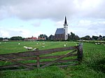
Texel De Waal Hogereind View East

De Waal is a village in the Dutch province of North Holland. It is a part of the municipality of Texel, and lies about 15 km north of Den Helder. The village was first mentioned in 1295 as "sancti Bonifacii in Waelkerken", and means "pond created after a dike breach". De Waal started to developed after the Waalenburg polder was created in 1436. The Dutch Reformed church is built on a terp (artificial hill). It was destroyed in 1945 during the Georgian uprising. A new church was built in 1952 and a tower was added in 1961.

Excerpt from the Wikipedia article De Waal (License: CC BY-SA 3.0, Authors, Images).

De Waal
Tienhoven, Texel

Geographical coordinates (GPS) Address Nearby Places
placeShow on map

Wikipedia: De WaalContinue reading on Wikipedia

Geographical coordinates (GPS)

Latitude Longitude
N 53.066666666667 ° E 4.8166666666667 °
placeShow on map

Address

Tienhoven

Tienhoven
1793 EC Texel
North Holland, Netherlands
mapOpen on Google Maps

Texel De Waal Hogereind View East
Share experience

Nearby Places

Action of 24 October 1798

The action of 24 October 1798 was a minor naval engagement of the French Revolutionary Wars, fought between a British Royal Navy frigate and two ships of the Batavian Navy. The Dutch ships were intercepted in the North Sea within hours of leaving port, 30 nautical miles (56 km) northwest of the Texel, by the British ship HMS Sirius. Both Dutch vessels were carrying large quantities of military supplies and French soldiers, reinforcements for the French and Irish forces participating in the Irish Rebellion of 1798. Although the rebellion had been defeated a month earlier, word of the British victory had not yet reached the European continent, and the Dutch force was intended to supplement a larger French squadron sent earlier in October. The French had already been defeated at the Battle of Tory Island and the Dutch suffered a similar outcome, both ships defeated in turn by the larger and better armed British vessel. Captain Richard King on Sirius discovered the Dutch ships early on 24 October, when they were separated by 2 nautical miles (3.7 km) and thus unable to mutually support one another. Targeting the smaller ship, Waakzaamheid, King was able to outrun her in an hour and force her to surrender without a fight. Turning his attention on the larger vessel, Furie, King rapidly overhauled her as well and opened a heavy fire, to which Furie was only able to ineffectively reply. Within half an hour she too had surrendered. Both ships were taken to Britain, repaired and commissioned in the Royal Navy. The defeat ended the last effort by the continental nations to land soldiers in Ireland, and signified the last action of the Irish Rebellion.