Czech lands

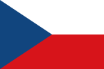
The Czech lands or the Bohemian lands (Czech: České země, pronounced [ˈtʃɛskɛː ˈzɛmɲɛ]) is a historical-geographical term that, in a historical context, refers the three historical regions of Bohemia, Moravia, and Czech Silesia together before Czechoslovakia and later the Czech Republic were formed. Together the three have formed the Czech part of Czechoslovakia since 1918 and the Czech Republic since 1 January 1993. In a historical context, Czech texts use the term to refer to any territory ruled by the Kings of Bohemia, i.e., the lands of the Bohemian Crown (země Koruny české) as established by Emperor Charles IV in the 14th century. This would include territories like the Lusatias (which in 1635 fell to Saxony) and the whole of Silesia, all ruled from Prague Castle at that time. After the conquest of Silesia by the Prussian king Frederick the Great in 1742, the remaining lands of the Bohemian Crown—Bohemia, Moravia and Austrian Silesia—have been more or less co-extensive with the territory of the modern-day Czech Republic.
Excerpt from the Wikipedia article Czech lands (License: CC BY-SA 3.0, Authors, Images).Czech lands
34610, okres Havlíčkův Brod
Geographical coordinates (GPS) Address Nearby Places Show on map
Geographical coordinates (GPS)
| Latitude | Longitude |
|---|---|
| N 49.75 ° | E 15.5 ° |
Address
34610
582 81 okres Havlíčkův Brod, Habry
Czechia
Open on Google Maps


