Chapel Rural Historic District
Clarke County, Virginia geography stubsColonial Revival architecture in VirginiaHistoric districts in Clarke County, VirginiaHistoric districts on the National Register of Historic Places in VirginiaNRHP infobox with nocat ... and 4 more
National Register of Historic Places in Clarke County, VirginiaQueen Anne architecture in VirginiaShenandoah Valley, Virginia Registered Historic Place stubsUse mdy dates from August 2023

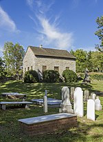
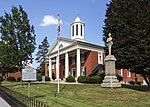
The Chapel Rural Historic District is an expansive rural historic district in Clarke County, Virginia. The district encompasses an area of nearly 11,500 acres (4,700 ha), a rural landscape that extends from Millwood in the south, nearly to Berryville in the north. The district takes its name from the Old Chapel, an 18th-century building that stands prominently at the junction of several roads near the center of the district. The district includes nearly 700 contributing properties.The district was listed on the National Register of Historic Places in 2014.
Excerpt from the Wikipedia article Chapel Rural Historic District (License: CC BY-SA 3.0, Authors, Images).Chapel Rural Historic District
Lord Fairfax Highway,
Geographical coordinates (GPS) Address Nearby Places Show on map
Geographical coordinates (GPS)
| Latitude | Longitude |
|---|---|
| N 39.107777777778 ° | E -78.014444444444 ° |
Address
Lord Fairfax Highway 8198
22611
Virginia, United States
Open on Google Maps


