place

William H. Long Memorial

Buildings and structures completed in 1890Buildings and structures in Merrimack County, New HampshireHopkinton, New HampshireMonuments and memorials on the National Register of Historic Places in New HampshireMuseums in Merrimack County, New Hampshire
National Register of Historic Places in Merrimack County, New Hampshire
HopkintonNH WilliamHLongMemorial

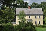
The William H. Long Memorial is a historic memorial building on Main Street in Hopkinton, New Hampshire. The brick, granite, and sandstone three-story building was constructed in 1890 as a memorial to a member of a prominent local family. The bequest stipulated that the building be used as a home for the local historical society, a function it continues to perform. It was also used to house the local public library. The building was designed by the Boston firm of Means & Gilbert, and is predominantly made of brick. The main entry, centered on the long wall, is recessed under a pilastered entablature topped by a semicircular tablet inscribed with the memorial inscription. Windows on the second floor are framed in ornamented stonework and topped by small oval oculus-like windows.The building was listed on the National Register of Historic Places in 1977.

Excerpt from the Wikipedia article William H. Long Memorial (License: CC BY-SA 3.0, Authors, Images).

William H. Long Memorial
Main Street,

Geographical coordinates (GPS) Address Nearby Places
placeShow on map

Wikipedia: William H. Long MemorialContinue reading on Wikipedia

Geographical coordinates (GPS)

Latitude Longitude
N 43.190833333333 ° E -71.671944444444 °
placeShow on map

Address

Harold Martin School

Main Street 271
03229
New Hampshire, United States
mapOpen on Google Maps

HopkintonNH WilliamHLongMemorial
Share experience

Nearby Places

Blackwater River (Contoocook River tributary)

The Blackwater River is a 37.5-mile-long (60.4 km) river located in central New Hampshire in the United States. It is a tributary of the Contoocook River, part of the Merrimack River watershed. The Blackwater River is formed at Cilleyville, a village in the western part of the town of Andover, by the junction of two branch streams. Cascade Brook, the western branch, begins at Cascade Marsh in the northeast part of Sutton and flows northeast to Wilmot Flat, where it is joined by the outlet of Pleasant Lake of New London before continuing east to Cilleyville. Frazier Brook, the northern stream branch, rises just south of Danbury village and flows south parallel to Route 4, passing South Danbury, flowing through Eagle Pond in Wilmot and then through Bog Pond below West Andover, joining Cascade Brook just south of the outlet of Bog Pond. Kimpton Brook (formerly known as Quickwater Brook), flowing easterly through the village of Wilmot Center, is the primary tributary of Eagle Pond. From its start at Cilleyville, the Blackwater River flows east through the town of Andover, passing the village of Potter Place. Beyond Andover village, the river continues to wind its way east, eventually turning south near the Blackwater Bays and dropping over rapids through the village of West Salisbury to the impoundment area of the Blackwater Dam in the town of Webster. Below the reservoir dam, the Blackwater encounters a short, intense whitewater stretch before flattening again for the final miles to the Contoocook in Hopkinton.