Helpe Majeure
France river stubsPages with French IPARivers of FranceRivers of Hauts-de-FranceRivers of Nord (French department) ... and 2 more
Rivers of the Ardennes (France)Tributaries of the Sambre

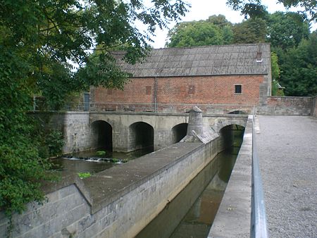
Helpe Majeure (French pronunciation: [ɛlp maʒœʁ]) is a river that runs through the Nord department in the Hauts-de-France region of France. It rises in the municipality of Ohain, with about a third of its watershed in Belgium, near the town of Momignies. The river initially marks the Franco-Belgian border as it flows north. Then it turns west and flows for 69 kilometres (43 mi) to its confluence north of Noyelles-sur-Sambre, as a southern tributary of the Sambre.
Excerpt from the Wikipedia article Helpe Majeure (License: CC BY-SA 3.0, Authors, Images).Helpe Majeure
Chemin de Halage, Avesnes-sur-Helpe
Geographical coordinates (GPS) Address Nearby Places Show on map
Geographical coordinates (GPS)
| Latitude | Longitude |
|---|---|
| N 50.1725 ° | E 3.7962 ° |
Address
Chemin de Halage
Chemin de Halage
59550 Avesnes-sur-Helpe
Hauts-de-France, France
Open on Google Maps


