place

Jedediah Foster Homesite

Archaeological sites on the National Register of Historic Places in MassachusettsNational Register of Historic Places in Worcester County, MassachusettsWest Brookfield, MassachusettsWorcester County, Massachusetts Registered Historic Place stubs
WestBrookfieldMA FosterHomesite

The Jedediah Foster Homesite is a historic archeological site on Foster Hill Road in West Brookfield, Massachusetts. The 0.5-acre (0.20 ha) site was the location of the stately 18th century home of Jedediah Foster, which was built in 1735 by his father-in-law, Joseph Dwight. Dwight (1703-1765) was a leading military figure in colonial Massachusetts, and was active locally in public service. Foster (1726-1779) was one of the most influential figures of his day in central Massachusetts. He served in the provincial assembly from 1761 to 1775, and supported American independence. In 1779 he was a member of the select committee of the constitutional convention that drafted the Massachusetts State Constitution (although John Adams is generally credited with doing most of the committee's work). Foster's home remained in family hands until it was given to the Quaboag Historical Society in 1902. It was shortly afterward destroyed by fire, and only foundations and other remnants survive. It is now a small local park. The site was listed on the National Register of Historic Places in 2013.

Excerpt from the Wikipedia article Jedediah Foster Homesite (License: CC BY-SA 3.0, Authors, Images).

Jedediah Foster Homesite
Foster Hill Road,

Geographical coordinates (GPS) Address Nearby Places
placeShow on map

Wikipedia: Jedediah Foster HomesiteContinue reading on Wikipedia

Geographical coordinates (GPS)

Latitude Longitude
N 42.232636 ° E -72.128533 °
placeShow on map

Address

Foster Hill Road 43
01585
Massachusetts, United States
mapOpen on Google Maps

WestBrookfieldMA FosterHomesite
Share experience

Nearby Places

West Brookfield Center Historic District

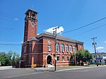
The West Brookfield Center Historic District is a historic district encompassing the historic center of West Brookfield, Massachusetts. When first listed on the National Register of Historic Places in 1990, it was centered on the triangular junction of Main Street, North Main Street, and School Street, extending away from this area along Main Street, North Main Street, and Foster Hill Road. A few of its properties lie on side streets adjacent to these roads. This area represented the core of Brookfield, before it was broken into smaller communities, including West Brookfield. It has a fine collection of 18th and 19th century homes, ranging stylistically from Federal to Queen Anne, as well as the town hall and public library.The district was enlarged in 2006 to include a residential and industrial area south of the center, primarily along Milk, Front, and Ware Streets. This area was developed largely after the arrival of the railroad in 1839. It is composed mainly of residential structures dating from that time to the early 20th century, although it does include a cluster of fairly nondescript 19th century railroad-related buildings, as well as two passenger depots: an Gothic Revival structure built between 1839 and 1847, and a Richardsonian Romanesque passenger station built in 1884 to a design by Springfield architect Eugene C. Gardner that was strongly influenced by those of H. H. Richardson, who had designed other depots for the Boston and Albany Railroad. The earlier station is among the oldest purpose-built railroad stations still standing in the United States.

Brookfield Cemetery
Brookfield Cemetery

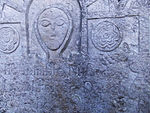
Brookfield Cemetery is an historic cemetery on Main Street (Massachusetts Route 9) on the west side of Brookfield, Massachusetts. Established in 1714, it is the town's only cemetery. It consequently holds the burials of many of Brookfield's founders and leading citizens, from the 18th century to the present, including those of neighboring towns that were once a part of Brookfield. The 43-acre (17 ha) cemetery has about 10,000 marked graves. It was listed on the National Register of Historic Places in 2003.The cemetery was developed in three distinct phases. Brookfield once encompassed most of what is now the towns of Warren, West Brookfield, and East Brookfield, with the West Brookfield area being the earliest area of settlement in the 1670s. First known as Quaboag Plantation, it was abandoned after a 1675 attack by Native Americans in King Philip's War, and resettlement only began early in the 18th century. Burial practices before 1714 are poorly documented. In that year local church members set aside the first plot of land for burials; this was confirmed by town officials after Brookfield was incorporated in 1720. The cemetery was at first owned as part of church lands, but 5 acres (2.0 ha) (the westernmost portion of the modern cemetery) were deeded to the town of Brookfield in 1760, probably as part of the division of the town into three parishes (which later became Brookfield, East Brookfield, and West Brookfield).During the 19th century the town undertook a number of improvements to the cemetery. A stone wall was built around it in the 1850s, and a receiving tomb was added in 1861. The large granite entrance gate was built in 1873, the gift of local residents William Banister and Otis Hayden Banister, and its Civil War memorial was dedicated in 1890. These were added in the central section of the cemetery, which was laid out in the Victorian rural cemetery style that was then fashionable.The easternmost part of the cemetery was developed beginning about 1920, and has been expanded several times, most recently in 1996. Its layout reflects the aesthetics of the 20th Century Modern Cemetery movement.

Brookfield Common Historic District

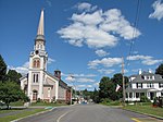
The Brookfield Common Historic District encompasses a historically significant portion of the town center of Brookfield, Massachusetts. It is focused on the town common, which extends south from Main Street (Massachusetts Route 9) to Lincoln Street, and includes a dense cluster of houses on roads to its east, as well as properties on Main Street and the Post Road. The district includes more than 100 properties, including the Colonial Revival Town Hall (designed 1904 by Worcester architect George H. Clemence), Banister Memorial Hall (an 1883 Queen Anne building designed by Wait & Cutter of Boston, which now houses the Merrick Public Library), and Romanesque Revival Congregation Church (built 1857 to a design by Boyden & Ball). The district was added to the National Register of Historic Places in 1990.The town of Brookfield was one of the first English settlements in what is now southern Worcester County, dating to 1665. What is now Brookfield is the result of the division of the community in the 1750s, separating North Brookfield and West Brookfield. The original town center was located in what is now West Brookfield; the present town center is organized around a common established in 1735 as a militia training ground, and where the town's Third Parish Congregational Church was established. The oldest surviving buildings in the village are houses built in the 1790s in the Federal style. The Brookfield Inn was originally established in one of these early houses, but was replaced in the 1860s after the original house was destroyed by fire.