place

Wickaboag Valley Historic District

Historic districts in Worcester County, MassachusettsHistoric districts on the National Register of Historic Places in MassachusettsNRHP infobox with nocatNational Register of Historic Places in Worcester County, MassachusettsUse mdy dates from August 2023
West Brookfield, MassachusettsWorcester County, Massachusetts Registered Historic Place stubs
WestBrookfieldMA QuinebaugValleyHD 01

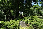
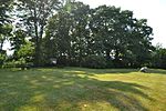
The Wickaboag Valley Historic District is a predominantly rural historic district in West Brookfield, Massachusetts. It is roughly bounded by Wickaboag Pond, Mill Stone Rd., Madden Rd., and the border with New Braintree. The central feature of the district is two branches of Sucker Brook, which empties into Wickaboag Pond, and the rural views of the valley through which these streams move. Except for a cluster of houses near Wickaboag Valley, Shea, Ragged Hill, and Millstone Roads, buildings are sparsely arranged on the roads that pass through the district. There are fourteen houses of historic interest, the oldest of which date to the 1790s. There are also archaeological remnants of the area's early industrial history, with documented mill sites dating to the late 17th century.The district was listed on the National Register of Historic Places in 2000.

Excerpt from the Wikipedia article Wickaboag Valley Historic District (License: CC BY-SA 3.0, Authors, Images).

Wickaboag Valley Historic District
Wickaboag Valley Road,

Geographical coordinates (GPS) Address Nearby Places
placeShow on map

Wikipedia: Wickaboag Valley Historic DistrictContinue reading on Wikipedia

Geographical coordinates (GPS)

Latitude Longitude
N 42.268888888889 ° E -72.159444444444 °
placeShow on map

Address

Wickaboag Valley Road

Wickaboag Valley Road
01585
Massachusetts, United States
mapOpen on Google Maps

WestBrookfieldMA QuinebaugValleyHD 01
Share experience

Nearby Places

West Brookfield Center Historic District

The West Brookfield Center Historic District is a historic district encompassing the historic center of West Brookfield, Massachusetts. When first listed on the National Register of Historic Places in 1990, it was centered on the triangular junction of Main Street, North Main Street, and School Street, extending away from this area along Main Street, North Main Street, and Foster Hill Road. A few of its properties lie on side streets adjacent to these roads. This area represented the core of Brookfield, before it was broken into smaller communities, including West Brookfield. It has a fine collection of 18th and 19th century homes, ranging stylistically from Federal to Queen Anne, as well as the town hall and public library.The district was enlarged in 2006 to include a residential and industrial area south of the center, primarily along Milk, Front, and Ware Streets. This area was developed largely after the arrival of the railroad in 1839. It is composed mainly of residential structures dating from that time to the early 20th century, although it does include a cluster of fairly nondescript 19th century railroad-related buildings, as well as two passenger depots: an Gothic Revival structure built between 1839 and 1847, and a Richardsonian Romanesque passenger station built in 1884 to a design by Springfield architect Eugene C. Gardner that was strongly influenced by those of H. H. Richardson, who had designed other depots for the Boston and Albany Railroad. The earlier station is among the oldest purpose-built railroad stations still standing in the United States.