Axenstrasse
Infobox road instances in SwitzerlandInfobox road maps tracking categoryInfrastructure completed in 1865Lake LucerneRoads in Switzerland

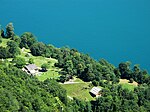
The Axenstrasse is an 11.4-kilometre-long (7.1 mi) two-lane middle section with ongoing traffic between the A4 motorway and the A2 motorway, and part of European route E41 between the resort of Brunnen in the canton of Schwyz to the village of Flüelen in the canton of Uri in Central Switzerland. The road is built along steep cliffs on the east side of the Urnersee (first part of the Lake Lucerne) weaving through many rock fall galleries and tunnels along its route. Upon completion in 1865, the Axenstrasse was the first way to get to Uri that did not involve navigating Lake Lucerne.
Excerpt from the Wikipedia article Axenstrasse (License: CC BY-SA 3.0, Authors, Images).Axenstrasse
Axenstrasse,
Geographical coordinates (GPS) Address Nearby Places Show on map
Geographical coordinates (GPS)
| Latitude | Longitude |
|---|---|
| N 46.953888888889 ° | E 8.6205555555556 ° |
Address
Axenstrasse
Axenstrasse
6452
Schwyz, Switzerland
Open on Google Maps


