place

Two Brothers Rocks–Dudley Road Historic District

Bedford, MassachusettsBillerica, MassachusettsHistoric districts in Middlesex County, MassachusettsHistoric districts on the National Register of Historic Places in MassachusettsMiddlesex County, Massachusetts Registered Historic Place stubs
NRHP infobox with nocatNational Register of Historic Places in Middlesex County, MassachusettsUse mdy dates from August 2023
Two Brothers Rocks, Bedford MA

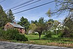
The Two Brothers Rocks–Dudley Road Historic District encompasses a historically significant rural area of Bedford and Billerica, Massachusetts. The district covers 230 acres (93 ha) of predominantly rural and residential property, along Dudley Street, a narrow, winding road that was laid out in colonial days. It also includes a significant amount of conservation land, including local, state, and federal lands. The federal lands of the Great Meadows National Wildlife Refuge which line the banks of the Concord River, include the "Two Brothers Rocks", which were used to mark a land boundary between grants given to early Massachusetts Bay Colony governors John Winthrop and Thomas Dudley, and which featured as boundary markers into the 20th century.The two large rocks were inscribed with the year 1638 and the names Dudley and Winthrop by a descendant of Dudley's named Dudley Leavitt Pickman, as noted in the Bedford Town Report in 1889.The district was listed on the National Register of Historic Places in 2010. The Two Brothers Rocks are accessible either via watercraft on the Concord River, or by trails through Bedford's Altmann Conservation Area.

Excerpt from the Wikipedia article Two Brothers Rocks–Dudley Road Historic District (License: CC BY-SA 3.0, Authors, Images).

Two Brothers Rocks–Dudley Road Historic District
Dudley Road,

Geographical coordinates (GPS) Address Nearby Places
placeShow on map

Wikipedia: Two Brothers Rocks–Dudley Road Historic DistrictContinue reading on Wikipedia

Geographical coordinates (GPS)

Latitude Longitude
N 42.520494 ° E -71.302968 °
placeShow on map

Address

Dudley Road

Dudley Road
01741
Massachusetts, United States
mapOpen on Google Maps

Two Brothers Rocks, Bedford MA
Share experience

Nearby Places

Farley-Hutchinson-Kimball House

The Farley-Hutchinson-Kimball House is a historic house and barn at 461A and 463 North Road in Bedford, Massachusetts. The property consists of a house whose oldest portions date to c. 1732, and an attached barn from the late 19th century that has been converted to residential use. The buildings were listed on the National Register of Historic Places in 2012.The main block of the house, a 2+1⁄2-story five-bay timber-frame structure, was probably built c. 1732 by Christopher Page, for his daughter Joanna and son-in-law Benjamin Farley. It was on property Page subdivided to make the gift and probably already had a house on it. The newer building is surmised to have been built between 1728 and 1732. The Farleys did not stay long in the house, moving to Dunstable, Massachusetts (a part that is now Hollis, New Hampshire) in 1733, selling their farmstead to Benjamin Hutchinson. In the 19th century it passed through several hands, until it was purchased in 1911 by Charles and Edith Kimball, who established a poultry farm on the premises. In 1913 the Kimballs embarked on a major renovation and expansion project, giving the house its Colonial Revival character.From about 1920 into the 1930s the Kimballs also made and sold candy on the premises, adapting the 19th century barn for those purposes. In 1946 the Kimballs converted to barn to two residential apartments. The only major later addition to the property was a c. 1979 kitchen addition to the house, which was executed in a historically sensitive way.

Bedford Veterans Affairs Medical Center

The Bedford Veterans Affairs Medical Center, also known as the Edith Nourse Rogers Memorial Veterans Hospital, is a medical facility of the United States Department of Veterans Affairs (VA) at 200 Springs Road in Bedford, Massachusetts. Its campus once consisted of about 276 acres (112 ha) of land, which had by 2012 been reduced to 179 acres (72 ha). The hospital was opened in 1928 to treat neuropsychiatric patients, but now provides a wider array of medical services. Through the efforts of Congresswoman Edith Nourse Rogers, the center was expanded to offer services to women in 1947; her role led to the center being renamed in her honor by President Jimmy Carter.The focal point of the complex is its Main Building, a three-story brick Classical Revival building that was built in 1928, and is still used as a medical care facility. South of this is the Administration building, also built in 1928. West of that is the former Kitchen and Dining Hall of 1928, which now houses offices and storage space. To its west is the 1929 Acute Care Building, now known as the Nursing Home Care Unit. Other buildings of the complex are located primarily north and south of this grouping, and are smaller in scale.In 2012, 177 acres of the remaining campus were listed as a historic district on the National Register of Historic Places. The district includes the main hospital buildings, as well as residential housing, utility and maintenance buildings, most of which were built no later than 1947, and some of which date to 1928, the earliest period of the facility's construction. It is an excellent example of an intact Period 2 neuropsychiatric VA hospital.