Blaenrheidol
Ceredigion geography stubsCommunities in Ceredigion
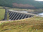
Blaenrheidol is a community in the county of Ceredigion, North Wales. It lies in the Cambrian Mountains of Mid Wales, approximately 12 miles (19 km) east of Aberystwyth on the A44 road, and includes Pumlumon. It includes the settlements of Ponterwyd, Ystumtuen and Llywernog. As the name suggests, a large section of the Afon Rheidol is in the community as well as the large man-made reservoir of Nant-y-moch.
Excerpt from the Wikipedia article Blaenrheidol (License: CC BY-SA 3.0, Authors).Blaenrheidol
Geographical coordinates (GPS) Address External links Nearby Places Show on map
Geographical coordinates (GPS)
| Latitude | Longitude |
|---|---|
| N 52.44039 ° | E -3.81669 ° |
Address
Blaenrheidol
, Blaenrheidol
Wales, United Kingdom
Open on Google Maps


