place

Government House (Quebec)

Burned buildings and structures in CanadaGovernment Houses in CanadaHouses in Quebec CityQuebec government buildingsRebuilt buildings and structures in Canada
Sillery, Quebec City
06M P16S4D19P029
06M P16S4D19P029

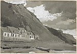
Quebec's Government House, known as Spencer Wood, was the viceregal residence of Quebec. It was built in 1854. Located at Bois-de-Coulonge Park (upstream of the Plains of Abraham and overlooking Anse-au-Foulon) in Sillery, it was purchased by the Quebec government in 1870, and served as the residence of Quebec lieutenant governors until 1966, when a major fire destroyed the main residence.

Excerpt from the Wikipedia article Government House (Quebec) (License: CC BY-SA 3.0, Authors, Images).

Government House (Quebec)
Grande Allée Ouest, Quebec Sillery (Sainte-Foy–Sillery–Cap-Rouge)

Geographical coordinates (GPS) Address Website External links Nearby Places
placeShow on map

Wikipedia: Government House (Quebec)Continue reading on Wikipedia

Geographical coordinates (GPS)

Latitude Longitude
N 46.7888889 ° E -71.24 °
placeShow on map

Address

Parc du Bois-de-Coulonge

Grande Allée Ouest 1215
G1S 1E7 Quebec, Sillery (Sainte-Foy–Sillery–Cap-Rouge)
Quebec, Canada
mapOpen on Google Maps

Website
capitale.gouv.qc.ca

linkVisit website

linkWikiData (Q2410305)
linkOpenStreetMap (162323961)

06M P16S4D19P029
06M P16S4D19P029
Share experience

Nearby Places

Anse au Foulon
Anse au Foulon

Anse au Foulon (English: Fuller's Handle) is a small cove in Quebec, Canada. It was located about one and one-half miles above Quebec City, in the formerly independent town of Sillery, until the 1st of January 2002, as part of the 2000–06 municipal reorganization in Quebec. Since that date, Anse au Foulon and Sillery (reconstituted as a neighbourhood (quartier)) have been officially located in Quebec City. The cove was known and referred to as Wolfe's Cove by Sillery's once-sizable English-speaking population. The first written reference to this appellation pertains to the event which took place at the cove and its cliff in 1759.On the night of 12 September 1759, and early morning hours on the 13th, British forces commanded by James Wolfe landed at Anse au Foulon, prior to proceeding to the Plains of Abraham, where they engaged and defeated the French forces commanded by the Marquis de Montcalm, resulting in the occupation of Quebec City, and the subsequent signing of the Treaty of Paris (1763). The treaty marked Great Britain's victory over France and Spain, during the Seven Years' War, and stipulated France's ceding of New France east of the Mississippi River to Great Britain. The etymology of the toponym originates from a fulling mill (French: foulon) that the Séminaire de Québec built in 1710, at the base of the cliff which met the cove. The mill's workers traveled on a path that became known as Foulon path (chemin du Foulon), as well as its plural (des Foulons). Despite the closure of the mill in 1734, the toponym of Foulon persisted. It was not until 1924, that the town of Sillery adopted the name of chemin du Foulon (also referred to a Cove Road) for the path turned into road. On 5 December 1968, the Commission de toponymie du Québec recognized Wolfe's Cove as the topographic feature's official name; however, this decision was superseded on 17 August 1978, when the commission recognized Anse au Foulon as the official name.

Mount Hermon Cemetery

Mount Hermon Cemetery is a garden (or rural) cemetery and National Historic Site of Canada. It is located in the Sillery district (French: quartier) of the Sainte-Foy–Sillery–Cap-Rouge borough (French: arrondissement) of Quebec City, Quebec, Canada. The cemetery was designated a National Historic Site of Canada in 2007.The impetus for the creation of the 11-hectare (26-acre) cemetery was the need for the provision of an Anglican burying ground for Quebec City's primarily English language speaking, Anglican community, in the mid–1800s.The cemetery is located at the corner of Saint-Louis Road (French: chemin Saint-Louis) and côte de Sillery (formerly côte de l'Église), on 109,010 m2 (0.042 sq mi) of land overlooking the Saint Lawrence River, in the southeastern direction.More than 17,000 people are buried at Mount Hermon. Mount Hermon Cemetery draws distinction as being the first garden cemetery (French: cimetière-jardin) established in Canada. Mount Hermon, and other garden cemeteries formed in North America, took inspiration from cimetière du Père-Lachaise of Paris.A memorial was dedicated to the victims of the sinking of the shipwrecked Empress of Ireland, in 1914, and other memorials were erected at later dates on the cemetery's grounds. The major loss of lives aboard the shipwrecked Empress of Ireland had significant impact upon Mount Hermon, along with its neighboring cemetery on chemin Saint-Louis: Saint-Patrick's Cemetery, which also relocated from the city of Quebec, in 1879. Both of the cemeteries took on responsibility for a significant number of the ship's passengers whom perished aboard or at sea. Separately, on the Mount Hermon grounds is the Treggett Bell, which was presented in gratitude to the Treggett family, who had members from four different generations of its family serve as Mount Hermon's Superintendents, encompassing the years 1865–2014.In addition, the cemetery contains sections dedicated for individuals of Greek (French: section de la communauté grecque orthodoxe), Chinese (French: section de la communauté chinoise), and Cambodian (French: lots des cambodgiens) descent.The main entrance is accessed at 1801 Saint-Louis Road, at the northern end of the cemetery. There is a pedestrian entrance located at the southwestern portion of the cemetery, accessed at the northern terminus of avenue des Voiliers, one-block east of côte de Sillery. The cemetery grounds contain both paved and gravel roads.