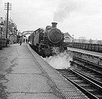
Lavendon
Areas of Milton KeynesBuckinghamshire geography stubsCivil parishes in BuckinghamshireVillages in Buckinghamshire

Lavendon is a village and civil parish in the unitary authority area of the City of Milton Keynes, Buckinghamshire, England. It is the northernmost village in the Milton Keynes UA and South East England, near Olney, about 8 miles (13 km) WNW of Bedford and 9 miles (14 km) NNE of Central Milton Keynes. Nearby places are Warrington, and Cold Brayfield in the Milton Keynes UA, and Harrold and Carlton over the border in Bedfordshire.
Excerpt from the Wikipedia article Lavendon (License: CC BY-SA 3.0, Authors, Images).Lavendon
Soames Close,
Geographical coordinates (GPS) Address Nearby Places Show on map
Geographical coordinates (GPS)
| Latitude | Longitude |
|---|---|
| N 52.172 ° | E -0.663 ° |
Address
Soames Close
MK46 4EJ
England, United Kingdom
Open on Google Maps


