Iver
Civil parishes in BuckinghamshireEngvarB from June 2014Villages in Buckinghamshire

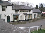
Iver is a large civil parish in Buckinghamshire, England. In addition to the central clustered village, the parish includes the residential neighbourhoods of Iver Heath and Richings Park.
Excerpt from the Wikipedia article Iver (License: CC BY-SA 3.0, Authors, Images).Iver
High Street,
Geographical coordinates (GPS) Address Nearby Places Show on map
Geographical coordinates (GPS)
| Latitude | Longitude |
|---|---|
| N 51.521 ° | E -0.507 ° |
Address
High Street
High Street
SL0 9NQ , Iver (Wexham and Ivers Community Board)
England, United Kingdom
Open on Google Maps


