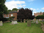
Widford, Hertfordshire
Civil parishes in HertfordshireEast Hertfordshire DistrictEngvarB from July 2016Villages in HertfordshireWidford, Hertfordshire

Widford is a village and civil parish between Ware and Much Hadham in the East Hertfordshire district of Hertfordshire in England. It covers an area of approximately 1,167 acres and contains 220 houses. The River Ash flows through the north of the parish. Widford had a population of 534 people in the 2011 census.
Excerpt from the Wikipedia article Widford, Hertfordshire (License: CC BY-SA 3.0, Authors, Images).Widford, Hertfordshire
Daintrees, East Hertfordshire Widford
Geographical coordinates (GPS) Address Nearby Places Show on map
Geographical coordinates (GPS)
| Latitude | Longitude |
|---|---|
| N 51.822 ° | E 0.06 ° |
Address
Daintrees
Daintrees
SG12 8SL East Hertfordshire, Widford
England, United Kingdom
Open on Google Maps


