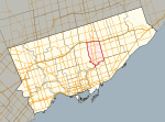
Don Mills

Don Mills is a mixed-use neighbourhood in the North York district of Toronto, Ontario, Canada. It was developed to be a self-supporting "new town" and was at the time located outside Toronto proper. In 1998, North York, including the Don Mills community, was amalgamated into Toronto proper. Consisting of residential, commercial and industrial sub-districts, it was planned and developed by private enterprise. In several ways it became the blueprint for postwar suburban development in Toronto and contemporary residential neighbourhoods. It is bounded by York Mills Road to the north, Canadian Pacific Railway to the south, Leslie Street to the west, and Don Valley Parkway to the east. It is part of federal and provincial electoral district Don Valley East, and Toronto electoral ward 16: Don Valley East.
Excerpt from the Wikipedia article Don Mills (License: CC BY-SA 3.0, Authors, Images).Don Mills
Don Mills Road, Toronto
Geographical coordinates (GPS) Address Nearby Places Show on map
Geographical coordinates (GPS)
| Latitude | Longitude |
|---|---|
| N 43.737222222222 ° | E -79.343333333333 ° |
Address
Don Mills Road 1112
M3C 0E5 Toronto (North York)
Ontario, Canada
Open on Google Maps


