Baby Point

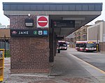
Baby Point is a residential neighbourhood in the York district of Toronto, Ontario, Canada. It is bounded on the west by the Humber River from south of Baby Point Crescent to St. Marks Road, east to Jane Street and Jane Street south to Raymond Avenue and Raymond Avenue west to the Humber. It is within the city-defined neighbourhood of 'Lambton-Baby Point.' Baby Point is within the proximity of Jane station. The neighbourhood was at one time an Iroquois village, called Teiaiagon. The village had a population of 5000 at its peak. The village was burnt to the ground in a French Army attack in 1687. In the 19th century, lawyer James Baby bought the land from the Upper Canada government, which had bought it as part of the Toronto Purchase. The land was developed into the current neighbourhood in the early 20th century. The name is pronounced by locals as "Babby" Point, to rhyme with tabby or cabbie, in an approximation of how James Baby pronounced his surname.
Excerpt from the Wikipedia article Baby Point (License: CC BY-SA 3.0, Authors, Images).Baby Point
Humbercrest Boulevard, Toronto York
Geographical coordinates (GPS) Address Nearby Places Show on map
Geographical coordinates (GPS)
| Latitude | Longitude |
|---|---|
| N 43.6575 ° | E -79.4925 ° |
Address
Humbercrest Boulevard 73
M6S Toronto, York
Ontario, Canada
Open on Google Maps


