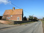
Grendon Underwood
Civil parishes in BuckinghamshireUse British English from August 2015Villages in Buckinghamshire

Grendon Underwood is a village and civil parish in west Buckinghamshire, England, near the border with Oxfordshire. The village sits between Woodham and Edgcott, near the Roman road Akeman Street (now part of the A41), and around 10 miles (16 km) north-west of Aylesbury. At the 2011 Census, the population of the civil parish was 1,625.
Excerpt from the Wikipedia article Grendon Underwood (License: CC BY-SA 3.0, Authors, Images).Grendon Underwood
The Broadway,
Geographical coordinates (GPS) Address Nearby Places Show on map
Geographical coordinates (GPS)
| Latitude | Longitude |
|---|---|
| N 51.8832 ° | E -1.0173 ° |
Address
The Broadway
HP18 0SU , Grendon Underwood
England, United Kingdom
Open on Google Maps


