Andrews Avenue

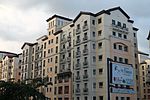
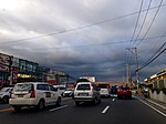
Andrews Avenue (formerly and still commonly known as Nichols Road) is a major east-west thoroughfare in Metro Manila, Philippines that functions as a metropolitan linkage between Pasay and Taguig. It runs underneath the NAIA Expressway almost parallel to Epifanio de los Santos Avenue (EDSA) to the north connecting Roxas Boulevard and Domestic Road near Bay City with South Luzon Expressway near Newport City. It has an arterial extension continuing 3.4 kilometers (2.1 mi) northeast to 5th Avenue and McKinley Road in Bonifacio Global City known as Lawton Avenue. Andrews Avenue also serves as the main feeder to Ninoy Aquino International Airport from the east and west and is the main access road to Newport World Resorts (formerly Resorts World Manila).
Excerpt from the Wikipedia article Andrews Avenue (License: CC BY-SA 3.0, Authors, Images).Andrews Avenue
Pasay Zone 20 (District 1)
Geographical coordinates (GPS) Address Nearby Places Show on map
Geographical coordinates (GPS)
| Latitude | Longitude |
|---|---|
| N 14.523611111111 ° | E 121.01083333333 ° |
Address
1309 Pasay, Zone 20 (District 1)
Philippines
Open on Google Maps


