Agglomeration community of Cholet
Agglomeration communities in FranceCholetIntercommunalities of Maine-et-LoireMaine-et-Loire geography stubsStates and territories established in 2017 ... and 1 more
Use mdy dates from May 2021

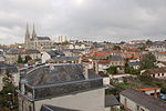
The Agglomération du Choletais, also simply known as CAC, is the intercommunal structure gathering the city of Cholet and its suburbs. It is located in the Maine-et-Loire département, in the Pays de la Loire région (France). It was formed on 1 January 2017 by the merger of the former Communauté d'agglomération du Choletais, the Communauté de communes du Bocage and the Communauté de communes du Vihiersois-Haut-Layon. Its area is 788.0 km2. Its population was 104,382 in 2018, of which 54,186 in Cholet proper.
Excerpt from the Wikipedia article Agglomeration community of Cholet (License: CC BY-SA 3.0, Authors, Images).Agglomeration community of Cholet
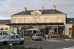
Rue des Ardoisiers, Cholet
Geographical coordinates (GPS) Address Nearby Places Show on map
Geographical coordinates (GPS)
| Latitude | Longitude |
|---|---|
| N 47.05 ° | E -0.9 ° |
Address
Rue des Ardoisiers 2
49300 Cholet (Cholet)
Pays de la Loire, France
Open on Google Maps


