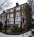
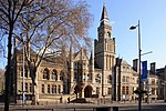
Ealing () is a district in West London, England. It is 7.5 miles (12.1 km) west of Charing Cross. In the London Borough of Ealing, it is one of the borough's seven major towns (alongside Acton, Greenford, Hanwell, Northolt, Perivale and Southall). Ealing, resembling the W5, W13 and NW10 post codes is the administrative centre of the borough. It is identified as a major metropolitan centre in the London Plan.Ealing is in the historic county of Middlesex. Until the urban expansion of London in the late 19th century and early 20th centuries, Ealing was a rural village within Ealing parish. Improvement in communications with London, culminating with the opening of the railway station in 1838, shifted the local economy to market garden supply and eventually to suburban development. By 1902 Ealing had become known as the "Queen of the Suburbs" due to its greenery, and because it was halfway between city and country.As part of the growth of London in the 20th century, Ealing significantly expanded and increased in population. It became a municipal borough in May 1901 and has formed part of Greater London since December 1965. It is now a significant commercial and retail centre with a developed night-time economy. Ealing has the characteristics of both leafy suburban and inner-city development. The Pitshanger neighbourhood and some others retain the lower density, greenery and architecture of suburban villages. Ealing's town centre is often referred to as Ealing Broadway, the name of both a railway interchange and a shopping centre.
Most of Ealing, including the commercial district, South Ealing, Ealing Common, Montpelier, Pitshanger and most of Hanger Hill fall under the W5 postcode. Areas to the north-west of the town centre such as Argyle Road and West Ealing fall under W13 instead. A small section north-east of the town centre, near Hanger Hill, falls under the NW10 postcode area. The population of Ealing (including Northfields) was 85,014 in the 2011 census.


