place

Halifax Needham

CanElecResTopTest with bare yearNova Scotia provincial electoral districtsPolitics of Halifax, Nova Scotia
Halifax Needham location

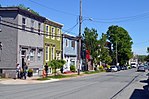
Halifax Needham is a provincial electoral district in Halifax, Nova Scotia, Canada, that elects one member of the Nova Scotia House of Assembly. It has existed since 1967, though its boundaries have changed periodically. Halifax Needham encompasses what is largely known as the North End of Halifax. It has been held by members of each of the three major political parties in Nova Scotia at different times. The riding was once the home of Liberal Premier Gerald Regan before going to Progressive Conservative Edmund L. Morris for the majority of the 1980s. Morris served as a Member of Parliament for Halifax under Progressive Conservative Prime Minister John Diefenbaker before becoming the Mayor of Halifax. He served in the Provincial Cabinet as Minister of Intergovernmental Affairs, Municipal Affairs, Fisheries, and Social Services. When he stepped down in 1988, the Progressive Conservatives lost the seat in that election to Gerry O'Malley, who was unseated from his position as Liberal Minister of Supply and Services in 1998. Maureen MacDonald held the seat from 1998 until 2016. The seat is considered a reasonably safe seat for the NDP, though the 2013 election was close, amid a province-wide swing to the Liberals. It was created in 1966 when Halifax North was divided into three districts, one of which was Halifax City North East. The district was renamed Halifax Needham in 1967. In 2003, it gained an area east of Citadel Hill from Halifax Citadel. In 2013, it lost the area south of Robie Street and east of Young Street to Halifax Chebucto and gained the area north of Bayers Road and east of Connaught Avenue from Halifax Chebucto.

Excerpt from the Wikipedia article Halifax Needham (License: CC BY-SA 3.0, Authors, Images).

Halifax Needham
Kane Place, Halifax Hydrostone

Geographical coordinates (GPS) Address Nearby Places
placeShow on map

Wikipedia: Halifax NeedhamContinue reading on Wikipedia

Geographical coordinates (GPS)

Latitude Longitude
N 44.6632 ° E -63.6 °
placeShow on map

Address

Kane Place 5508
B3K 2B3 Halifax, Hydrostone
Nova Scotia, Canada
mapOpen on Google Maps

Halifax Needham location
Share experience

Nearby Places

Nova Scotia Cotton Manufacturing Company

The Nova Scotia Cotton Manufacturing Company was a cotton mill located in Halifax, Nova Scotia which was founded in 1882 and destroyed with great loss of life by the Halifax Explosion in 1917. The company was formed as part of an effort to industrialize the Maritime provinces of Canada and switch from merchant shipping to manufacturing under Canada's National Policy. Typical of the regional enthusiasm for industry in the 1880s, the company was quickly capitalized by 32 local investors within two weeks, drawn from a who's who of Halifax manufacturers, merchants and business leaders including railway engineer Sandford Fleming. Carefully studying other cotton mills, the company built a state-of-the-art mill on Robie Street in North End, Halifax, bringing in textile workers from Lancashire, England. Halifax City Council paid for water mains and subsidized the construction of a five-mile railway spurline from the Intercolonial Railway's yards on the waterfront. The "cotton factory spur", as it came to be known, created Halifax's first industrial park along Robie Street, attracting other factories such as the Silliker Car Works, the Henderson & Potts Paint factory and later the railway shops of the Canadian Government Railways. The mill began production in 1883. It produced plain cotton with a workforce of 600, half of them women including a dozen girls under 16. By the end of the 1880s, it was the second largest employer in Halifax, after the Acadia Sugar Refinery, and the seventh largest producer of cotton in Canada. The company paid small dividends in the first few years but soon feel into debt and had to cut production, dropping to 317 workers by 1891. The mill found it difficult to compete with much larger textile mills in Montreal and Toronto and provided historians with a classic example of the difficulty of Maritime firms to compete with larger Canadian competitors. It was purchased in January 1891 by the Dominion Cotton Mills Company of Montreal, the first purchase in a string of acquisitions by the Montreal firm which became Dominion Textile.The mill was destroyed on December 6, 1917 by an accidental explosion of a munitions ship in Halifax Harbour known as the Halifax Explosion. Although almost a mile from the explosion and out-of-sight of the harbour, the mill was devastated by the explosion. The shock wave caused a partial collapse of the concrete floors of the building and started a fire which consumed the building and killed many of the workers.After the explosion, Dominion Textile shifted production to other mills. The walls and first floor of the mill remained and were roofed over to store supplies for the city's reconstruction. The Halifax lumber and building supply firm Piercey's opened in the former factory in the 1920s and continued to operate from the building until Rona built a new store on the adjacent lot on Almon Street about 2014. The building was demolished in 2016 and is now a vacant lot.

Halifax Explosion
Halifax Explosion

The Halifax Explosion was a disaster that occurred in Halifax, Nova Scotia, Canada, on the morning of 6 December 1917. SS Mont-Blanc, a French cargo ship laden with high explosives, collided with the Norwegian vessel SS Imo in the Narrows, a strait connecting the upper Halifax Harbour to Bedford Basin. A fire on board the Mont-Blanc led to a massive explosion that devastated the Richmond district of Halifax. 1,782 people were killed, largely in Halifax and Dartmouth, by the blast, debris, fires, or collapsed buildings, and an estimated 9,000 others were injured. The blast was the largest human-made explosion at the time, releasing the equivalent energy of roughly 2.9 kilotons of TNT (12 TJ).Mont-Blanc was under orders from the French government to carry her cargo from New York City via Halifax to Bordeaux, France. At roughly 8:45 am, she collided at low speed, approximately one knot (1.2 mph or 1.9 km/h), with the unladen Imo, chartered by the Commission for Relief in Belgium to pick up a cargo of relief supplies in New York. On the Mont-Blanc, the impact damaged benzol barrels stored on deck, leaking vapours which were ignited by sparks from the collision, setting off a fire on board that quickly grew out of control. Approximately 20 minutes later at 9:04:35 am, the Mont-Blanc exploded. Nearly all structures within an 800-metre (half-mile) radius, including the community of Richmond, were obliterated. A pressure wave snapped trees, bent iron rails, demolished buildings, grounded vessels (including Imo, which was washed ashore by the ensuing tsunami), and scattered fragments of Mont-Blanc for kilometres. Across the harbour, in Dartmouth, there was also widespread damage. A tsunami created by the blast wiped out the community of the Mi'kmaq First Nation who had lived in the Tufts Cove area for generations. Relief efforts began almost immediately, and hospitals quickly became full. Rescue trains began arriving the day of the explosion from across Nova Scotia and New Brunswick while other trains from central Canada and the northeastern United States were impeded by blizzards. Construction of temporary shelters to house the many people left homeless began soon after the disaster. The initial judicial inquiry found Mont-Blanc to have been responsible for the disaster, but a later appeal determined that both vessels were to blame. In the North End, there are several memorials to the victims of the explosion.