place

Te Rāpaki-o-Te Rakiwhakaputa

Canterbury, New Zealand geography stubsPopulated places in Canterbury, New ZealandUse New Zealand English from December 2015
Lyttelton Harbour, Rapaki in foreground

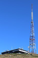
Te Rāpaki-o-Te Rakiwhakaputa, commonly known as Rāpaki or Rapaki, is a small settlement within the Lyttelton Harbour basin.Rāpaki is one of four Banks Peninsula rūnanga (communities) based around marae (tribal meeting grounds). The Rāpaki Marae, also known as Te Wheke Marae, is a meeting ground of Ngāi Tahu and its Te Hapū o Ngāti Wheke branch. It includes a wharenui (meeting house), called Te Wheke to be opened in 2008, was carved by Riki Manuel and Fayne Robinson and the tukutuku panels were overseen by local weaver 'Aunty' Doe Parata. The carvings of the wharenui trace the almost 400 years of continuous settlement related to the arrival of the ancestor Te Rakiwhakaputa. Rāpaki is overlooked by the peak Te Poho o Tamatea. According to one legend, the Ngāi Tahu chief Te Rakiwhakaputa named the place by laying his waist mat (rāpaki) down to claim it. The full name of Rāpaki is Te Rāpaki-o-Te Rakiwhakaputa, meaning the waist mat of Te Rakiwhakaputa. On 8 July 2020, the New Zealand Geographic Board assigned the full name as the official name of the locality.

Excerpt from the Wikipedia article Te Rāpaki-o-Te Rakiwhakaputa (License: CC BY-SA 3.0, Authors, Images).

Te Rāpaki-o-Te Rakiwhakaputa
Governors Bay Road, Banks Peninsula Community Rapaki

Geographical coordinates (GPS) Address Nearby Places
placeShow on map

Wikipedia: Te Rāpaki-o-Te RakiwhakaputaContinue reading on Wikipedia

Geographical coordinates (GPS)

Latitude Longitude
N -43.604 ° E 172.6795 °
placeShow on map

Address

Rapaki

Governors Bay Road
8971 Banks Peninsula Community, Rapaki
Canterbury, New Zealand
mapOpen on Google Maps

Lyttelton Harbour, Rapaki in foreground
Share experience

Nearby Places

C93FM

C93FM was a New Zealand radio station based in Christchurch. C93FM broadcast on 92.9 FM and, after it merged with Radio Avon, also broadcast on 1260 AM. C93FM has had several music formats during its time on the air. In 1989 the station was rebranded as 93FM Gold and in 1990 93FM Classic Hits. Then in 1991 the station reverted to C93FM with a new logo and playing classic rock and continued to play classic rock until 1999 when the station was changed to an Adult Contemporary music format. Originally C93FM was an independent station operated by a company of the same name, C93FM Limited. The company also operated a second station Easy Listening i94.5 until 1997. The Radio Network made two attempts to purchase C93FM Limited, in March and May 1997; both were rejected by the Commerce Commission on the basis that they would give the company a dominant position in the Christchurch radio market. Instead, C93FM and Easy Listening I were sold to Radio Otago. Easy Listening i94 became Lite FM in 1998. Following the sale of C93FM Limited to Radio Otago, C93FM was started in Dunedin by rebranding local rock station 93Rox as C93FM. The Dunedin-based C93FM was then networked to Invercargill on 90.8FM and was originally branded as C91FM. On air the announcers simply called the station "Classic Rock." Later in 1998 C91FM in Invercargill became known as C93FM. In 1999 Radio Otago was sold to the Radioworks and in Invercargill and Dunedin C93FM was replaced with network station The Rock. The Rock was also networked into Christchurch at the same time broadcasting on 93.7FM and as a result the format of C93FM was changed to an Adult Contemporary format. Also, the original 1260AM frequency used by C93 was replaced with Solid Gold as there were no other FM frequencies for Solid Gold to broadcast on at the time. The changes made to C93FM were not popular, and the station failed to attract new listeners as a result. C93FM went off the air in April 2001 and the 92.9FM frequency was taken over by Solid Gold, which later became The Sound in 2012, changing back to a classic rock format. Solid Gold also kept the 1260AM frequency until 2005 when it was used by Radio Pacific.

Bridle Path (New Zealand)

The Bridle Path is a steep shared-use track that traverses the northern rim of the Lyttelton volcano connecting the port of Lyttelton with the city of Christchurch in the South Island of New Zealand. It is a popular walking and mountain biking route. The track ascends from the port itself to a height of 333 metres (1,093 ft) before descending again via Heathcote Valley to Christchurch. At the summit, next to the Summit Road, is a stone shelter with covered seats that is a 1940 New Zealand centennial memorial to the Pioneer Women of Canterbury. There are also seven commemorative stone seats placed along the Bridle Path; most of these were built for the 1950 Canterbury centenary celebrations. Hastily constructed in late 1850, just in time for the first Canterbury Association settlers to use, it was the most direct way to travel from the port to the new settlements on the plains on the northern side of the Port Hills. Although very steep, it was the primary means of traversing the hills until the Sumner Road over Evans Pass was opened to light traffic in 1858. Originally, the road over Evans Pass was intended to be completed by the time the first settlers arrived but the Canterbury Association ran out of money. John Robert Godley had the road work stopped, and only had enough time to cut a rough Bridle Road once obtained further funding. It is referred to as a bridle path because the track was so steep and narrow in places that riders needed to dismount and lead their horses by the bridle. The path was considered unsuitable for a fully loaded cart or dray. The track is a legal road, so may be used by motor vehicles, such as trail bikes, though this is regarded as a nuisance. There have been attempts to change the legal status from road to park since the 1970s.