Gerrards Cross

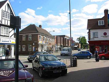
Gerrards Cross is a town and civil parish in south Buckinghamshire, England, separated from the London Borough of Hillingdon at Harefield by Denham, south of Chalfont St Peter and north bordering villages of Fulmer, Hedgerley, Iver Heath and Stoke Poges. It spans foothills of the Chiltern Hills and land on the right bank of the River Misbourne. It is 19.3 miles (31.1 km) west-north-west of Charing Cross, central London. Bulstrode Park Camp was an Iron Age fortified encampment. The town has a railway station on the Chiltern Main Line with regular services to London. Fast train takes 19 minutes to Marylebone. The town is close to M25 motorway and the M40 motorway runs beside woodland on its southern boundary. In 2014, a major national surveying company named Gerrards Cross as the most sought-after and expensive commuter town or village in their London Hot 100 report, with an average sale price of £1,000,000.
Excerpt from the Wikipedia article Gerrards Cross (License: CC BY-SA 3.0, Authors, Images).Gerrards Cross
Packhorse Road,
Geographical coordinates (GPS) Address Nearby Places Show on map
Geographical coordinates (GPS)
| Latitude | Longitude |
|---|---|
| N 51.587 ° | E -0.554 ° |
Address
Gerrards Cross Post Office
Packhorse Road
SL9 7QL , Gerrards Cross (Denham, Gerrards Cross and Chalfonts Community Board)
England, United Kingdom
Open on Google Maps


