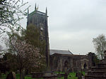
Chew Valley
The Chew Valley is an affluent area in North Somerset, England, named after the River Chew, which rises at Chewton Mendip, and joins the River Avon at Keynsham. Technically, the area of the valley is bounded by the water catchment area of the Chew and its tributaries; however, the name Chew Valley is often used less formally to cover other nearby areas, for example, Blagdon Lake and its environs, which by a stricter definition are part of the Yeo Valley. The valley is an area of rich arable and dairy farmland, interspersed with a number of villages. The landscape consists of the valley of the River Chew and is generally low-lying and undulating. It is bounded by higher ground ranging from Dundry Down to the north, the Lulsgate Plateau to the west, the Mendip Hills to the south and the Hinton Blewett, Temple Cloud, Clutton and Marksbury plateau areas to the east. The valley's boundary generally follows the top of scarp slopes except at the southwestern and southeastern boundaries where flat upper areas of the Chew Valley grade gently into the Yeo Valley and eastern Mendip Hills respectively. The River Chew was dammed in the 1950s to create Chew Valley Lake, which provides drinking water for the nearby city of Bristol and surrounding areas. The lake is a prominent landscape feature of the valley, a focus for recreation, and is internationally recognised for its nature conservation interest, because of the bird species, plants and insects. The area falls into the domains of councils including Bath and North East Somerset, North Somerset and Mendip. Part of the area falls within the Mendip Hills Area of Outstanding Natural Beauty. Most of the undeveloped area is within the Bristol/Bath Green Belt. Many of the villages date back to the time of the Domesday Book and there is evidence of human occupation since the Stone Age. There are hundreds of listed buildings with the churches being Grade I listed. The main commercial centre is Chew Magna.
Excerpt from the Wikipedia article Chew Valley (License: CC BY-SA 3.0, Authors).Chew Valley
Geographical coordinates (GPS) Address Nearby Places Show on map
Geographical coordinates (GPS)
| Latitude | Longitude |
|---|---|
| N 51.337421 ° | E -2.615197 ° |
Address
Stowey-Sutton
, Stowey-Sutton
England, United Kingdom
Open on Google Maps


