Stoneleigh-Rodgers Forge, Maryland
Former census-designated places in MarylandGeography of Baltimore County, MarylandTowson, Maryland
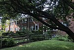
Stoneleigh-Rodgers Forge was a Census-designated place in Baltimore County during the 1960 United States Census, which consists of the communities of Stoneleigh and Rodgers Forge. The population in 1960 was 15,645. The census area merged with Towson in 1970, when the population of Towson CDP increased from 19,090 to 77,768. The ZIP code serving the area is 21212.
Excerpt from the Wikipedia article Stoneleigh-Rodgers Forge, Maryland (License: CC BY-SA 3.0, Authors).Stoneleigh-Rodgers Forge, Maryland
Woodbrook Lane, Towson
Geographical coordinates (GPS) Address Nearby Places Show on map
Geographical coordinates (GPS)
| Latitude | Longitude |
|---|---|
| N 39.377777777778 ° | E -76.630277777778 ° |
Address
Woodbrook Lane 25
21212 Towson
Maryland, United States
Open on Google Maps


