Hirfynydd
Marilyns of WalesMountains and hills of Neath Port TalbotUse British English from August 2015
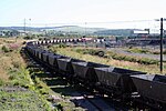
Hirfynydd is a 481-metre-high hill in Neath Port Talbot county borough in South Wales. A Roman road, Sarn Helen, runs along its entire northeast–southwest ridge-line, a route followed by a modern-day byway. To its west is Cwm Dulais and to its southeast is the Vale of Neath. The northern end of the ridge falls away to a broad upland vale containing the Afon Pyrddin and beyond which is the Brecon Beacons National Park. The larger part of the hill is afforested with conifers. In between the plantations are areas of past or present opencasting for coal.
Excerpt from the Wikipedia article Hirfynydd (License: CC BY-SA 3.0, Authors).Hirfynydd
Sarn Helen (BY 28/39.N.Hi/1),
Geographical coordinates (GPS) Address Nearby Places Show on map
Geographical coordinates (GPS)
| Latitude | Longitude |
|---|---|
| N 51.75503 ° | E -3.68306 ° |
Address
Sarn Helen (BY 28/39.N.Hi/1)
Sarn Helen (BY 28/39.N.Hi/1)
SA10 9AP , Seven Sisters
Wales, United Kingdom
Open on Google Maps


