Botolph Claydon
Buckinghamshire geography stubsHamlets in Buckinghamshire

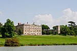
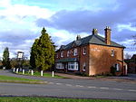
Botolph Claydon is a hamlet in the civil parish of East Claydon, in Buckinghamshire, England. It is situated about 9 miles (14 km) east of Bicester in Oxfordshire, and 7 miles (11 km) north west of Aylesbury. Anciently the hamlet was called Botyl Claydon. The prefix comes from the Anglo-Saxon word botyl meaning 'house'. The word Claydon is also Anglo Saxon, and means 'clay hill'. The village hall, built in 1912, was once the village library and was donated to the villages of East and Botolph Claydon by the Verney Family.
Excerpt from the Wikipedia article Botolph Claydon (License: CC BY-SA 3.0, Authors, Images).Botolph Claydon
Orchard Way,
Geographical coordinates (GPS) Address Nearby Places Show on map
Geographical coordinates (GPS)
| Latitude | Longitude |
|---|---|
| N 51.914362 ° | E -0.935769 ° |
Address
Orchard Way
Orchard Way
MK18 2NF
England, United Kingdom
Open on Google Maps


