place

East Claydon

Buckinghamshire geography stubsCivil parishes in BuckinghamshireVillages in Buckinghamshire
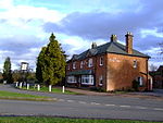
Tree shelter, East Claydon geograph.org.uk 410040

East Claydon is a village and is also a civil parish in the unitary authority of Buckinghamshire, England. It is about 2+1⁄2 miles (4 km) south-west of Winslow. The village name 'Claydon' is Anglo Saxon in origin, and derives from the Old English: clægig + dun meaning 'clay hill'. The affix 'East' is used to differentiate the village from nearby Steeple Claydon and Middle Claydon, and from the hamlet of Botolph Claydon that lies within the parish of East Claydon. The parish church dedicated to St Mary was demolished during the English Civil War by Cornelius Holland, one of King Charles's judges, but was rebuilt after the restoration. The current structure is largely of 18th century design, but comprises components from various centuries, the earliest of which is the 13th century. East Claydon School is a mixed, community, nursery, infant and junior school, which takes children from the age of three through to the age of 11, when they generally move to a school in Waddesdon or Winslow. The school is quite small, with approximately seventy pupils.

Excerpt from the Wikipedia article East Claydon (License: CC BY-SA 3.0, Authors, Images).

East Claydon
Sandhill Road,

Geographical coordinates (GPS) Address Nearby Places
placeShow on map

Wikipedia: East ClaydonContinue reading on Wikipedia

Geographical coordinates (GPS)

Latitude Longitude
N 51.9241 ° E -0.929 °
placeShow on map

Address

Sandhill Road

Sandhill Road
MK18 2LX
England, United Kingdom
mapOpen on Google Maps

Tree shelter, East Claydon geograph.org.uk 410040
Share experience

Nearby Places

Verney Junction railway station

Verney Junction railway station was an isolated railway station at a four-way railway junction in Buckinghamshire, open from 1868 to 1968; a junction existed at the site without a station from 1851. The first line to open on the site was the Buckinghamshire Railway, which opened a line from Bletchley to Banbury in 1850; a line branching west to Oxford followed in 1851. This formed an east–west link from Oxford to Bletchley and Cambridge passing through Verney Junction and this, known as the Varsity line, became the busiest line through the site, leaving the line to Banbury as a relatively quiet branch. The station opened in 1868 concurrently with the opening of the Aylesbury and Buckingham Railway (later owned by London Underground) towards Aylesbury and London. Soon after the Buckinghamshire Railway became absorbed into the London and North Western Railway. The lines south to Aylesbury closed to passengers in 1936 and the line to Buckingham in 1964, but the station remained open until the Oxford-Cambridge line closed to passengers in 1968. The track was singled and then mothballed, but a disused track has remained through the station site. As part of East West Rail, the line between Oxford and Bletchley is to be reopened by 2025, but because of its isolated location Verney Junction will not be reopened. While never very busy, Verney Junction was a local interchange point for a century from which excursions as far as Ramsgate could be booked. Situated 50 miles (80 km) from Baker Street, the station is one of London's disused Underground stations and, although it never carried heavy traffic, the Aylesbury line was important in the expansion of the Metropolitan Railway into what became Metro-land.

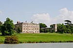
Addington, Buckinghamshire

Addington is a village and civil parish in Buckinghamshire, England, about 2 miles (3.2 km) west of Winslow and 3 miles (4.8 km) south east of Buckingham. According to the 2001 and 2011 census' it had a population of 145. It is part of the Buckinghamshire Council unitary authority area. First recorded as Edintone in the Domesday Book of 1086, its name means Eadda's Estate. Nearby Adstock is named after the same person. The manor at that time was in the possession of Odo, Bishop of Bayeux. A notable building in the village is the Mansion House, which is a 19th-century building on the site of the much older manor. The former manor house was used twice during the English Civil War as the national headquarters of the Parliamentarian forces. During the Second World War from 1940 to 1945 Addington House was the residence or safe-house of the Moravec, Strankmüller and Tauer families of the Czechoslovak Military Intelligence staff, who had their headquarters in London. It was Colonel František Moravec who planned the assassination of Reinhard Heydrich (although this was masterminded in London not at Addington). The President of Czechoslovakia, Edvard Beneš, lived at The Abbey in nearby Aston Abbotts. The parish church is dedicated to St. Mary the Virgin. The church has three bells (the oldest dating as far back as 1666) hung for English change ringing and one sanctus bell hung for chiming. Possibly in November 1890, a temperature of -21.1 °C (-5.8 °F) was recorded. However, the temperature is of dubious authenticity and if it is correct, it would be the lowest temperature in November in England.