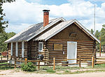
Black Forest Fire

The Black Forest Fire was a forest fire that began near Highway 83 and Shoup Road in Black Forest, Colorado around 1:00 p.m. on June 11, 2013. As of June 20, 2013, the fire was 100 percent contained, 14,280 acres (22.31 sq mi; 57.8 km2) were burned, at least 509 homes were said to be destroyed, and two people had died. This was the most destructive fire in the state's history at the time, surpassing the 2012 Waldo Canyon Fire which also began near Colorado Springs. It was surpassed in 2021, when the Marshall Fire destroyed over 1,000 homes in Boulder County, in Superior and Louisville.The evacuation area covered 94,000 acres (147 sq mi; 380 km2) acres, 13,000 homes and 38,000 people. Three shelters were established in the area, including Elbert County Fairgrounds, which accepted humans, pets, and large animals. Two other shelters were designated for large animals only. On June 13, the Denver Post reported, 457 firefighters were working the fireline, including agencies around the fire, the Colorado Air National Guard, and select personnel from fire suppression teams on Fort Carson and the nearby United States Air Force Academy. Of note, 3 x UH-60 and 3 x CH-47 from 2-4 GSAB along with some crews from 3-4 AHB (4th Combat Aviation Brigade) were instrumental in providing immediate response to assist in fighting the fires. The Battalion, commanded by LTC Tyler Smith, launched with very little notice to provide much needed support to the Front Range region. One of the CH-47D aircraft "Patches", was involved in the effort on every day. Governor John Hickenlooper addressed Emergency Managers at the command post on June 12. U.S. Northern Command assisted with fire fighting efforts.
Excerpt from the Wikipedia article Black Forest Fire (License: CC BY-SA 3.0, Authors, Images).Black Forest Fire
Falcon Drive,
Geographical coordinates (GPS) Address Nearby Places Show on map
Geographical coordinates (GPS)
| Latitude | Longitude |
|---|---|
| N 39.016 ° | E -104.75 ° |
Address
Falcon Drive 12690
Colorado, United States
Open on Google Maps


