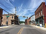
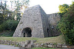
Gilmore, Maryland
Allegany County, Maryland geography stubsCensus-designated places in Allegany County, MarylandCensus-designated places in MarylandCumberland, MD-WV MSAPopulated places in the Cumberland, MD-WV MSA ... and 1 more
Use mdy dates from July 2023
Gilmore is an unincorporated community and census-designated place (CDP) in Allegany County, Maryland, United States. As of the 2010 census it had a population of 127. It is part of the Cumberland, MD-WV Metropolitan Statistical Area. Gilmore lies in the valley of Georges Creek, a tributary of the North Branch Potomac River, between Dans Mountain to the southeast and Big Savage Mountain to the northwest. Maryland Route 36 runs north–south through the community. Midland is directly to the north, and Lonaconing is 2 miles (3 km) to the southwest.
Excerpt from the Wikipedia article Gilmore, Maryland (License: CC BY-SA 3.0, Authors).Gilmore, Maryland
Lower Georges Creek Road Southwest,
Geographical coordinates (GPS) Address Nearby Places Show on map
Geographical coordinates (GPS)
| Latitude | Longitude |
|---|---|
| N 39.582777777778 ° | E -78.95 ° |
Address
Lower Georges Creek Road Southwest
Lower Georges Creek Road Southwest
21532
Maryland, United States
Open on Google Maps


