Electoral district of City of Melbourne

The Electoral district of City of Melbourne was one of the original sixteen electoral districts of the old unicameral Victorian Legislative Council of 1851 to 1856; Victoria having been made a separate colony in Australia in the former year. The Electoral district of City of Melbourne's area contained the North Melbourne and part of Jika Jika parishes, and was bound in part by Merri Creek, Moonee Ponds and Hobson's Bay.William Westgarth had been a representative in the New South Wales Legislative Council for the City of Melbourne, and topped the poll for this new district in Victoria. From 1856 onwards, the Victorian parliament consisted of two houses, the Victorian Legislative Council (upper house, consisting of Provinces) and the Victorian Legislative Assembly (lower house).
Excerpt from the Wikipedia article Electoral district of City of Melbourne (License: CC BY-SA 3.0, Authors, Images).Electoral district of City of Melbourne
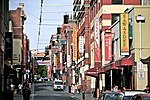
Bourke Street, Melbourne Melbourne
Geographical coordinates (GPS) Address Phone number Website Nearby Places Show on map
Geographical coordinates (GPS)
| Latitude | Longitude |
|---|---|
| N -37.813611111111 ° | E 144.96305555556 ° |
Address
Melbourne's GPO
Bourke Street 350
3000 Melbourne, Melbourne
Victoria, Australia
Open on Google Maps


