Holybourne Hill
Hampshire geography stubsHills of Hampshire

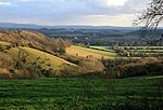
Holybourne Hill or Holybourne Down is one of the highest points in the county of Hampshire, England, and in the Hampshire Downs, rising to 225 metres (738 ft) above sea level. Holybourne Hill rises not far from the village of Holybourne in Hampshire.
Excerpt from the Wikipedia article Holybourne Hill (License: CC BY-SA 3.0, Authors, Images).Holybourne Hill
Froyle Road, East Hampshire Froyle
Geographical coordinates (GPS) Address Nearby Places Show on map
Geographical coordinates (GPS)
| Latitude | Longitude |
|---|---|
| N 51.1876 ° | E -0.964 ° |
Address
Froyle Road
GU34 4BY East Hampshire, Froyle
England, United Kingdom
Open on Google Maps


