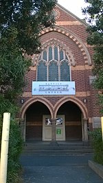
Electoral district of East Bourke Boroughs

East Bourke Boroughs was an electoral district of the Legislative Assembly in the Australian state of Victoria from 1859 to 1904. The district was defined in the Electoral Districts Act of 1858 as: Commencing at a point on the east bank of the Moonee Ponds, being the northwestern angle of portion of CXLII., parish of Jika Jika; thence by a line bearing east, and by the northern, eastern, and southern boundaries of the town reserve of Pentridge to the Merri Creek ; thence southwards by the Merri Creek to the south-western angle of portion CXXIII. in the said parish ; thence by a line bearing east to the Darebin Creek; thence southwards by the Darebin Creek to the river Yarra Yarra; thence by the river Yarra Yarra to the Merri Creek aforesaid; thence northwards by the Merri Creek to the south-eastern angle of portion XC. in the said parish; thence west by the southern boundaries of portion XC. and XCI. to the Moonee Ponds aforesaid; and thence northwards by the Moonee Ponds to the commencing point ...
Excerpt from the Wikipedia article Electoral district of East Bourke Boroughs (License: CC BY-SA 3.0, Authors, Images).Electoral district of East Bourke Boroughs
Murdock Street, Melbourne Brunswick
Geographical coordinates (GPS) Address Nearby Places Show on map
Geographical coordinates (GPS)
| Latitude | Longitude |
|---|---|
| N -37.758333333333 ° | E 144.95833333333 ° |
Address
Murdock Street
Murdock Street
3056 Melbourne, Brunswick
Victoria, Australia
Open on Google Maps


