place

A368 road

England road stubsGeographic coordinate listsInfobox road instances in the United KingdomInfobox road maps tracking categoryLists of coordinates
Roads in EnglandRoads in SomersetUse British English from February 2013
A368 at Chelwood geograph.org.uk 1206920

The A368 is a part primary status A road in North Somerset, England. It runs from Marksbury (near Bath) to Banwell (near Weston-super-Mare) along the northern edge of the Mendip Hills and past the reservoir at Chew Valley Lake. The road runs through the village of Chelwood, where there is a roundabout for the junction with the A37, then via the village of Bishop Sutton to the large reservoir at Chew Valley Lake before crossing the B3114 at West Harptree. It then runs via Compton Martin to another smaller reservoir at Blagdon Lake. At Burrington, there is a turning for the B3134 which leads through Burrington Combe. The road crosses the A38 at traffic lights just west of Churchill, and goes through Sandford before ending at Banwell on the A371.

Excerpt from the Wikipedia article A368 road (License: CC BY-SA 3.0, Authors, Images).

A368 road
Cleeve Hill,

Geographical coordinates (GPS) Address Nearby Places
placeShow on map

Wikipedia: A368 roadContinue reading on Wikipedia

Geographical coordinates (GPS)

Latitude Longitude
N 51.3162 ° E -2.6747 °
placeShow on map

Address

Cleeve Hill

Cleeve Hill
BS40 6PG
England, United Kingdom
mapOpen on Google Maps

A368 at Chelwood geograph.org.uk 1206920
Share experience

Nearby Places

Church of St Michael the Archangel, Compton Martin

The Parish church of St Michael the Archangel (grid reference ST545570) is in the village of Compton Martin, Somerset, England. The church is a grade I listed building, and several of the monuments in the church yard also have listed status., The church is dedicated to St Michael the Archangel. The church, which was built in the 12th century in a Norman style funded by William FitzWalter. The tower was added in 1441. Norman vaulting can be seen in the chancel, arcades firming aisles north and south of the nave and clerestory. There is Jacobean work in choir stalls and organ screen. In the north wall is a recess containing the effigy of Thomas de Moreton which was discovered in 1858. One of the columns in the South side of the nave has an unusual spiral fluted decoration known as an apprentices column.Above the ceiling of the Bickfield Chapel there is a void which contains a columbarium or dovecote. This housed 140 “squabs” or pigeons in 1606 for the rector's table.The four stage tower is approached from the nave via a lofty Tudor paneled arch which together with the tower itself which is supported by diagonal buttresses, dates from c. 1370 or 1443. It is some 70 feet (21 m) high and contains six 18th-century bells, five of which were cast by the Bilbies of Chew Stoke. Wade and Wade in their 1929 book "Somerset" described the church as "quite remarkable" "The church is one of the finest bits of Norm. work in the county. The nave is entirely late Norm., and possesses the unusual feature of a clerestory. The fine arcades, with their cylindrical columns and circular abaci, are too obvious to escape notice, but particular attention should be paid to the twisted pillar on the N.E. The chancel has an extremely low quadripartite vault, the effect of which is rather spoilt by the distortion of the chancel arch through some defect in the foundations. The aisles are Perp., and the one on the S. curiously encloses the clerestory. Note (1) the junction of the Perp. arch and Norm. pillars, (2) recessed effigy of a lady at E. end of N. aisle, (3) semi-circular recess, probably for additional altar (cp. Cudworth); (4) Norm. font on a fluted pedestal, (5) Perp. screen, said to have been an importation. There is a Perp. W. tower of weak design and poor workmanship, opening into the nave by a panelled arch."The parish is part of the benefice of Blagdon with Compton Martin and Ubley.

Church of St Mary, Nempnett Thrubwell

The Anglican Church of St Mary stands on Knap Hill in Nempnett Thrubwell, Somerset, England dates from the 15th century, but was built on the site of an earlier Norman church. It is a Grade II* listed building,Before the dissolution of the monasteries the parish belonged to Flaxley Abbey in Gloucestershire. In 1537 the land and manor were granted to Sir William Kingston. The parish register lists christenings, marriages and burials from 1568. The three stage tower, which contains five bells, has set back buttresses and two arch bell openings with tracery. The tower is crowned by a parapet with blank arcading, and square pinnacles, it also has a slightly higher stair turret. The nave was restored at a cost of £700 in 1864. The late Victorian chancel of 1897 is in the decorated style. Inside the church is a screen attributed to Pugin, although Nikolaus Pevsner is of the opinion the architect is probably Pugin the younger.The base of a 15th-century cross in the churchyard is listed Grade II.Wade and Wade in their 1929 book "Somerset" described it as "a small building with a Perp. W. tower, from the W. face of which project two curious and uncanny carved heads of a man and beast. The walls of the nave still bear the original 13th cent. consecration crosses. The chancel is modern, and contains a rich modern screen and a good E. window of Munich glass. Note (1) rude Norm. S. doorway filled with Perp. tracery; (2) Norm. font carved with a curious device by some later craftsman. Near the porch in the churchyard is (1) base of ancient cross; (2) tomb of first rector — Robert — bearing an incised cross".

Plaster's Green Meadows

Plaster's Green Meadows (grid reference ST532611) is a 4.3 hectare biological Site of Special Scientific Interest near the village of Nempnett Thrubwell, Bath and North East Somerset, notified in 1989. This is an area of unimproved and traditionally managed species-rich meadows which support a neutral grassland community of a type which is now rare throughout Britain. The site is situated on the slopes fringing the Lias Tablelands and is underlain by Rhaetic clays and, lower down the slope Keuper Red Marl. The slowly permeable clay soils are slightly calcareous in nature and this is reflected in elements of the flora. The site is characterised by the nationally rare Common Knapweed (Centaurea nigra) and Crested Dog’s-tail (Cynosurus cristatus) and dominant grasses include Sweet Vernal-grass (Anthoxanthum odoratum), Crested Dog’s-tail and Yorkshire Fog (Holcus lanatus), while Quaking Grass (Briza media) and Yellow Oat-grass (Trisetum flavescens) are also frequent. There is a high component of herb species throughout the meadows including Saw-wort (Serratuta tinctoria), Dyer’s Greenweed (Genista tinctoria), Common Knapweed, Pepper-saxifrage (Silaum silaus), Devil’s-bit Scabious (Succisa pratensis), Betony (Stachys officinalis) and Spiny Restharrow (Ononis spinosa). The calcareous nature of the soil is reflected by the presence of Cowslip (Primula veris), Fairy Flax (Linum catharticum), Glaucous Sedge (Carex flacca), Lady’s Bedstraw (Galium verum) and occasional Salad Burnet (Sanguisorba minor). The meadows are bounded by hedges supporting numerous species including Hawthorn (Crataegus monogyna), Wych Elm (Ulmus glabra), English Elm (Ulmus procera), Hazel (Corylus avellana) and Field Maple (Acer campestre). Hedgerow trees include Ash (Fraxinus excelsior), Sweet Chestnut (Castanea sativa), Holly (Ilex aquifolium) and Oak (Quercus spp.).

Charterhouse Camp
Charterhouse Camp

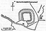
Charterhouse Camp is a univallate Iron Age hillfort in the Mendip district of Somerset, England. The hillfort is situated approximately 0.6 miles (0.97 km) east from the village of Charterhouse. There is some evidence, in the form of burials in local caves, of human occupation since the late Neolithic times and the early Bronze Age. The site is associated with Charterhouse Roman Town and may have been the site of Iscalis. The site is a scheduled monument.Hillforts developed in the Late Bronze and Early Iron Age, roughly the start of the first millennium BC. The reason for their emergence in Britain, and their purpose, has been a subject of debate. It has been argued that they could have been military sites constructed in response to invasion from continental Europe, sites built by invaders, or a military reaction to social tensions caused by an increasing population and consequent pressure on agriculture. The dominant view since the 1960s has been that the increasing use of iron led to social changes in Britain. Deposits of iron ore were located in different places to the tin and copper ores necessary to make bronze, and as a result trading patterns shifted and the old elites lost their economic and social status. Power passed into the hands of a new group of people.Archaeologist Barry Cunliffe believes that population increase still played a role and has stated "[the forts] provided defensive possibilities for the community at those times when the stress [of an increasing population] burst out into open warfare. But I wouldn't see them as having been built because there was a state of war. They would be functional as defensive strongholds when there were tensions and undoubtedly some of them were attacked and destroyed, but this was not the only, or even the most significant, factor in their construction".

Wurt Pit and Devil's Punchbowl

Wurt Pit and Devil's Punchbowl (grid reference ST543537) is a 0.2 hectare (0.5 acre) geological Site of Special Scientific Interest between East Harptree and the Priddy Circles in the Mendip Hills, Somerset, notified in 1987. Natural England describes the site as: "This site consists of the two largest subsidence depressions in the Mendips, formed by the underlying limestones having been dissolved by subterranean waters causing the surface rocks to collapse into the void. Clear evidence of their being collapsed structures rather than erosional or solutional features, is gained from the fact that the surface rocks at both localities are insoluble, being marls at Devil's Punchbowl and a series of limestones and clays which have been impregnated by silica at Wurt Pit." "The silica-enrichment of the limestones and clays at Wurt Pit (known as the 'Harptree Beds', of early Jurassic age) is also of considerable mineralogical importance since it took place as part of the main phase of mineralisation which emplaced the principal Mendip orefields during Jurassic times. The Harptree Beds show varying degrees of silica-enrichment, and also contain traces of other minerals, such as limonite and yellow ochre (hydrous ferric oxides), barite (barium sulphate), sphalerite (zinc sulphide) and galena (lead sulphide)." Wade and Wade, in their 1929 book Somerset, described the Devil's Punch Bowl as one of the most notable Swallet Holes on the Mendips