place

Compton Martin Ochre Mine

Bath and North East SomersetCaves of the Mendip HillsEnvironment of SomersetLimestone cavesMines in Somerset
Sites of Special Scientific Interest in AvonSites of Special Scientific Interest notified in 1988Use British English from February 2023
Compton Martin Ochre Mine

Compton Martin Ochre Mine (grid reference ST543566) is a 0.85 hectare geological and biological Site of Special Scientific Interest located on the north side of the Mendip Hills, immediately south west of Compton Martin village, Somerset, notified in 1988.

Excerpt from the Wikipedia article Compton Martin Ochre Mine (License: CC BY-SA 3.0, Authors, Images).

Compton Martin Ochre Mine
The Coombe,

Geographical coordinates (GPS) Address Nearby Places
placeShow on map

Wikipedia: Compton Martin Ochre MineContinue reading on Wikipedia

Geographical coordinates (GPS)

Latitude Longitude
N 51.3067 ° E -2.657 °
placeShow on map

Address

Compton Martin Ocre Mine

The Coombe
BS40 6JD
England, United Kingdom
mapOpen on Google Maps

Compton Martin Ochre Mine
Share experience

Nearby Places

Church of St Michael the Archangel, Compton Martin

The Parish church of St Michael the Archangel (grid reference ST545570) is in the village of Compton Martin, Somerset, England. The church is a grade I listed building, and several of the monuments in the church yard also have listed status., The church is dedicated to St Michael the Archangel. The church, which was built in the 12th century in a Norman style funded by William FitzWalter. The tower was added in 1441. Norman vaulting can be seen in the chancel, arcades firming aisles north and south of the nave and clerestory. There is Jacobean work in choir stalls and organ screen. In the north wall is a recess containing the effigy of Thomas de Moreton which was discovered in 1858. One of the columns in the South side of the nave has an unusual spiral fluted decoration known as an apprentices column.Above the ceiling of the Bickfield Chapel there is a void which contains a columbarium or dovecote. This housed 140 “squabs” or pigeons in 1606 for the rector's table.The four stage tower is approached from the nave via a lofty Tudor paneled arch which together with the tower itself which is supported by diagonal buttresses, dates from c. 1370 or 1443. It is some 70 feet (21 m) high and contains six 18th-century bells, five of which were cast by the Bilbies of Chew Stoke. Wade and Wade in their 1929 book "Somerset" described the church as "quite remarkable" "The church is one of the finest bits of Norm. work in the county. The nave is entirely late Norm., and possesses the unusual feature of a clerestory. The fine arcades, with their cylindrical columns and circular abaci, are too obvious to escape notice, but particular attention should be paid to the twisted pillar on the N.E. The chancel has an extremely low quadripartite vault, the effect of which is rather spoilt by the distortion of the chancel arch through some defect in the foundations. The aisles are Perp., and the one on the S. curiously encloses the clerestory. Note (1) the junction of the Perp. arch and Norm. pillars, (2) recessed effigy of a lady at E. end of N. aisle, (3) semi-circular recess, probably for additional altar (cp. Cudworth); (4) Norm. font on a fluted pedestal, (5) Perp. screen, said to have been an importation. There is a Perp. W. tower of weak design and poor workmanship, opening into the nave by a panelled arch."The parish is part of the benefice of Blagdon with Compton Martin and Ubley.
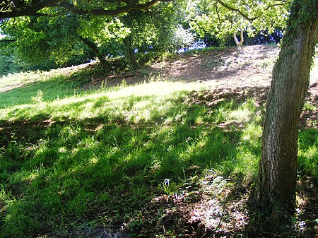
Wurt Pit and Devil's Punchbowl

Wurt Pit and Devil's Punchbowl (grid reference ST543537) is a 0.2 hectare (0.5 acre) geological Site of Special Scientific Interest between East Harptree and the Priddy Circles in the Mendip Hills, Somerset, notified in 1987. Natural England describes the site as: "This site consists of the two largest subsidence depressions in the Mendips, formed by the underlying limestones having been dissolved by subterranean waters causing the surface rocks to collapse into the void. Clear evidence of their being collapsed structures rather than erosional or solutional features, is gained from the fact that the surface rocks at both localities are insoluble, being marls at Devil's Punchbowl and a series of limestones and clays which have been impregnated by silica at Wurt Pit." "The silica-enrichment of the limestones and clays at Wurt Pit (known as the 'Harptree Beds', of early Jurassic age) is also of considerable mineralogical importance since it took place as part of the main phase of mineralisation which emplaced the principal Mendip orefields during Jurassic times. The Harptree Beds show varying degrees of silica-enrichment, and also contain traces of other minerals, such as limonite and yellow ochre (hydrous ferric oxides), barite (barium sulphate), sphalerite (zinc sulphide) and galena (lead sulphide)." Wade and Wade, in their 1929 book Somerset, described the Devil's Punch Bowl as one of the most notable Swallet Holes on the Mendips