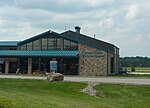
Chestnut Ridge (Laurel Highlands)
Appalachian MountainsLandforms of Fayette County, PennsylvaniaLandforms of Indiana County, PennsylvaniaLandforms of Monongalia County, West VirginiaLandforms of Preston County, West Virginia ... and 4 more
Landforms of Westmoreland County, PennsylvaniaLaurel HighlandsRidges of PennsylvaniaRidges of West Virginia

Chestnut Ridge is the westernmost ridge of the Allegheny Mountains in Pennsylvania, United States. It is located primarily within the Laurel Highlands region of southwestern Pennsylvania, extending into northern West Virginia.
Excerpt from the Wikipedia article Chestnut Ridge (Laurel Highlands) (License: CC BY-SA 3.0, Authors, Images).Chestnut Ridge (Laurel Highlands)
Unity Township
Geographical coordinates (GPS) Address Nearby Places Show on map
Geographical coordinates (GPS)
| Latitude | Longitude |
|---|---|
| N 40.233333333333 ° | E -79.366388888889 ° |
Address
15696 Unity Township
Pennsylvania, United States
Open on Google Maps


