Chamberlayne Industrial Center
Neighborhoods in Richmond, VirginiaRichmond, Virginia geography stubs

The Chamberlayne Industrial Center, sometimes simply known as Chamberlayne is a heavy industry district within the boundaries of Richmond, Virginia's North Side region. The neighborhood contains a mixture of residential, commercial industrial-zoned areas, but most of the residential and commercial buildings are in the eastern corner of the neighborhood. The neighborhood is named after Chamberlayne Avenue (U.S. Route 1) which serves as the spine for the neighborhood. Chamberlayne lies just north of Interstate 64, Virginia Commonwealth University's Monroe Park campus, and the Carver neighborhood. It is southeast of Virginia Union University.
Excerpt from the Wikipedia article Chamberlayne Industrial Center (License: CC BY-SA 3.0, Authors, Images).Chamberlayne Industrial Center
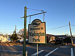
Forest Lawn Drive, Richmond Washington Park
Geographical coordinates (GPS) Address Nearby Places Show on map
Geographical coordinates (GPS)
| Latitude | Longitude |
|---|---|
| N 37.597402 ° | E -77.440739 ° |
Address
Northside Dog Park
Forest Lawn Drive
23227 Richmond, Washington Park
Virginia, United States
Open on Google Maps


