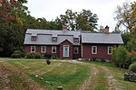
Haley Farm State Park
1970 establishments in ConnecticutGroton, ConnecticutParks in New London County, ConnecticutProtected areas established in 1970State parks of Connecticut ... and 1 more
Use mdy dates from August 2023

Haley Farm State Park is a public recreation area that preserves Colonial-era farmland as open space in the town of Groton, Connecticut. The site of the state park once formed part of the lands granted to Governor John Winthrop and later became a dairy farm. The park's 267 acres (108 ha) are connected to the adjacent Bluff Point State Park by way of a pedestrian bridge over railroad tracks. Park activities are restricted to bicycling and walking. The park is managed by Connecticut Department of Energy and Environmental Protection.
Excerpt from the Wikipedia article Haley Farm State Park (License: CC BY-SA 3.0, Authors, Images).Haley Farm State Park
Dolphin Road,
Geographical coordinates (GPS) Address External links Nearby Places Show on map
Geographical coordinates (GPS)
| Latitude | Longitude |
|---|---|
| N 41.331944444444 ° | E -72.009166666667 ° |
Address
Haley Farm State Park
Dolphin Road
06388
United States
Open on Google Maps


