Hopemead State Park
1954 establishments in ConnecticutBozrah, ConnecticutMontville, ConnecticutParks in New London County, ConnecticutProtected areas established in 1954 ... and 2 more
State parks of ConnecticutUse mdy dates from August 2023

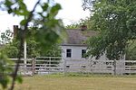
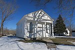
Hopemead State Park is an undeveloped public recreation area on the eastern shore of Gardner Lake, 8 miles (13 km) west of Norwich, Connecticut. The state park covers 60 acres (24 ha) in the towns of Bozrah and Montville and is managed by the Connecticut Department of Energy and Environmental Protection.
Excerpt from the Wikipedia article Hopemead State Park (License: CC BY-SA 3.0, Authors, Images).Hopemead State Park
Laurel Lane,
Geographical coordinates (GPS) Address External links Nearby Places Show on map
Geographical coordinates (GPS)
| Latitude | Longitude |
|---|---|
| N 41.517222222222 ° | E -72.2175 ° |
Address
Hopemead State Park
Laurel Lane
06420
Connecticut, United States
Open on Google Maps


