place

Bonneville Dam

1937 establishments in Oregon1937 establishments in Washington (state)Buildings and structures in Multnomah County, OregonBuildings and structures in Skamania County, WashingtonColumbia River Gorge
Dams completed in 1937Dams in OregonDams in Washington (state)Dams on the Columbia RiverDams on the National Register of Historic Places in OregonDams on the National Register of Historic Places in Washington (state)Dams with fish laddersEnergy infrastructure completed in 1937Gravity damsHistoric American Engineering Record in OregonHistoric American Engineering Record in Washington (state)Historic Civil Engineering LandmarksHistoric Columbia River HighwayHydroelectric power plants in OregonHydroelectric power plants in Washington (state)Industry museums in OregonLocks of OregonLocks of Washington (state)Museums in Multnomah County, OregonNRHP infobox with nocatNational Historic Landmarks in OregonNational Historic Landmarks in Washington (state)National Register of Historic Places in Multnomah County, OregonNational Register of Historic Places in Skamania County, WashingtonNew Deal in OregonNew Deal in Washington (state)Public Works Administration in OregonRun-of-the-river power stationsUnited States Army Corps of Engineers damsUse mdy dates from August 2023
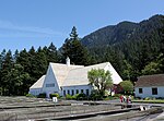
Spillway, Bonneville Dam 2

Bonneville Lock and Dam consists of several run-of-the-river dam structures that together complete a span of the Columbia River between the U.S. states of Oregon and Washington at River Mile 146.1. The dam is located 40 miles (64 km) east of Portland, Oregon, in the Columbia River Gorge. The primary functions of Bonneville Lock and Dam are electrical power generation and river navigation. The dam was built and is managed by the United States Army Corps of Engineers. At the time of its construction in the 1930s it was the largest water impoundment project of its type in the nation, able to withstand flooding on an unprecedented scale. Electrical power generated at Bonneville is distributed by the Bonneville Power Administration. Bonneville Dam is named for Army Capt. Benjamin Bonneville, an early explorer credited with charting much of the Oregon Trail. The Bonneville Dam Historic District was designated a National Historic Landmark District in 1987.

Excerpt from the Wikipedia article Bonneville Dam (License: CC BY-SA 3.0, Authors, Images).

Bonneville Dam
Dam Road,

Geographical coordinates (GPS) Address Nearby Places
placeShow on map

Wikipedia: Bonneville DamContinue reading on Wikipedia

Geographical coordinates (GPS)

Latitude Longitude
N 45.644166666667 ° E -121.94055555556 °
placeShow on map

Address

Dam Road

Dam Road
98639
Oregon, United States
mapOpen on Google Maps

Spillway, Bonneville Dam 2
Share experience

Nearby Places

Fort Cascades
Fort Cascades

Fort Cascades was a United States Army fort constructed in 1855 to protect the portage road around the final section of the Cascades Rapids, known as the "lower cascades." It was built on the Washington side of the Columbia River, between the present site of North Bonneville and the Bonneville Dam in Skamania County. It was burned in 1856, then rebuilt, but abandoned in 1861. A small community, Cascades, formed around the fort, but the largest flood of the Columbia River in recorded history passed over both the townsite and the fort site in 1894. Cascades served as the county seat of Skamania County prior to 1893, when the county records were moved to Stevenson, In 1867, decades before the disastrous floods, famed photographer Carleton Eugene Watkins arrived on the scene. Watkins took a commission from the Oregon Steam Ship Navigation Company to document areas of the Columbia River, with "Cascades" featuring prominently in his Pacific Coast stereoviews collection. Approximately 50 Watkins stereoscopic images of the Cascades area are known to exist, ranging from serials 1250-1302. Labeled "Upper Cascades," "Cascades" and "Lower Cascades," these photographs feature river view landscapes as well as images of the town and fort blockhouses. Aside from capturing scenery, Watkins documents saw mills, as well as train and riverboat traffic vital to the local economy at that time. A few of the images provide a glimpse of salmon fishing before the rapids were submerged by the construction of the Bonneville Dam. Although his negatives were destroyed in the great 1906 San Francisco earthquake, many of his printed images can be found in museums and private collections around the world.Fort Cascades is now on the National Register of Historic Places. There is a self-guided tour through what remains of the fort and the townsite. The trail the tour follows is approximately 1.5 miles (2.4 km) long. There is also a replica of a rock covered with petroglyphs that was originally located at the site but has since been moved to Stevenson. Fort Cascades is one of several forts built to protect the portage around the Cascade Rapids. Others are Fort Raines and Fort Lugenbeel.

Sheridan State Scenic Corridor

Sheridan State Scenic Corridor is a state park in the Columbia River Gorge, west of Cascade Locks, Oregon. The 11-acre (4.5 ha) property, containing an old-growth forest, is located on the south side of Interstate 84 at approximately milepoint 42.5, and was not accessible by motor vehicle since I-84 was built in 1960. However, with the opening of the Eagle Creek-Cascade Locks segment of the Historic Columbia River Highway State Trail in 1998, it has become easily accessible by foot or bicycle. The park is on a triangular lot, surrounded by I-84 and the Mount Hood National Forest. The park was acquired in 1923 from the Oregon-Washington Railroad and Navigation Company by the Parks Division of the State Highway Department, which named it for Philip H. Sheridan. It served as a wayside on US 30 - the Historic Columbia River Highway - until 1960, when the new I-84 freeway replaced the old road, cutting off access except through the national forest. As part of the restoration of the old highway, the Federal Highway Administration rebuilt the abandoned Eagle Creek-Cascade Locks for non-motorized traffic in the 1990s, to be managed by the State Parks and Recreation Department. An interpretive sign was installed at the site in 2007.Just to the east of the park, within the national forest the trail passes under I-84 in a 150-foot (50 m) long precast concrete rock-faced tunnel (45.6501°N 121.9107°W / 45.6501; -121.9107). The $500,000 structure was built as part of the restoration project, and was required to connect the park to another intact piece of road, located north of I-84 at the west Cascade Locks interchange.