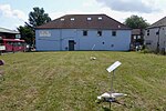
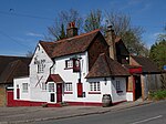
St Paul's Cray
Areas of LondonDistricts of the London Borough of BromleyFormer civil parishes in LondonFormer civil parishes in the London Borough of BromleyIrish Travellers ... and 1 more
Use British English from September 2015
St Paul's Cray is an area of South East London, England, within the London Borough of Bromley and the historic county of Kent. It is located south of Sidcup and north of Orpington.
Excerpt from the Wikipedia article St Paul's Cray (License: CC BY-SA 3.0, Authors).St Paul's Cray
Wateringbury Close, London St Paul's Cray (London Borough of Bromley)
Geographical coordinates (GPS) Address Nearby Places Show on map
Geographical coordinates (GPS)
| Latitude | Longitude |
|---|---|
| N 51.3998 ° | E 0.1067 ° |
Address
Wateringbury Close 35
BR5 2EL London, St Paul's Cray (London Borough of Bromley)
England, United Kingdom
Open on Google Maps


