Housatonic Meadows State Park
1927 establishments in ConnecticutCornwall, ConnecticutParks in Litchfield County, ConnecticutProtected areas established in 1927Sharon, Connecticut ... and 2 more
State parks of ConnecticutUse mdy dates from August 2023

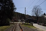
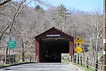
Housatonic Meadows State Park is a public recreation area covering 452 acres (183 ha) along the Housatonic River in the towns of Sharon and Cornwall, Connecticut. The state park offers opportunities for camping, hiking, picnicking, canoeing, and fly-fishing. It is crossed by the Appalachian Trail and is managed by the Connecticut Department of Energy and Environmental Protection.
Excerpt from the Wikipedia article Housatonic Meadows State Park (License: CC BY-SA 3.0, Authors, Images).Housatonic Meadows State Park
Caesar Brook Trail,
Geographical coordinates (GPS) Address Nearby Places Show on map
Geographical coordinates (GPS)
| Latitude | Longitude |
|---|---|
| N 41.845 ° | E -73.378333333333 ° |
Address
Caesar Brook Trail
Caesar Brook Trail
Connecticut, United States
Open on Google Maps


