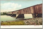
Windsor Locks Canal State Park Trail
Parks in Hartford County, ConnecticutState parks of ConnecticutSuffield, ConnecticutUse mdy dates from August 2023Windsor Locks, Connecticut

Windsor Locks Canal State Park Trail is a public recreation area that parallels the Connecticut River for 4.5 miles (7.2 km) between Suffield and Windsor Locks, Connecticut. The modern paved surface covers the original dirt towpath of the historic Enfield Falls Canal. The park is used for fishing, hiking, and biking.
Excerpt from the Wikipedia article Windsor Locks Canal State Park Trail (License: CC BY-SA 3.0, Authors, Images).Windsor Locks Canal State Park Trail
Windsor Locks Canal State Park Trail,
Geographical coordinates (GPS) Address External links Nearby Places Show on map
Geographical coordinates (GPS)
| Latitude | Longitude |
|---|---|
| N 41.986388888889 ° | E -72.605277777778 ° |
Address
Windsor Locks Canal State Park Trail
Windsor Locks Canal State Park Trail
06078
Connecticut, United States
Open on Google Maps


