place

Kranzberg (mountain)

Alpine three-thousandersBernese AlpsMountains of SwitzerlandMountains of ValaisMountains of the Alps
Valais mountain stubs
AletschGlacier
AletschGlacier

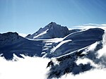
The Kranzberg (3,742 m) is a mountain of the Bernese Alps, overlooking the Aletsch Glacier in the Swiss canton of Valais, close to the border with the canton of Bern. Its massif separates two glaciers: the Grosser Aletschfirn and the Jungfraufirn, both part of the Aletsch Glacier. A prominent unnamed secondary summit (3,666 m) is located south-east of the main peak. Debris accumulating on both sides of the mountain form one of the two important supraglacial moraines of the Aletsch Glacier (see picture on the top right of the article).

Excerpt from the Wikipedia article Kranzberg (mountain) (License: CC BY-SA 3.0, Authors, Images).

Geographical coordinates (GPS)

Latitude Longitude
N 46.522083333333 ° E 7.9811111111111 °
placeShow on map

Address

Fieschertal


Wallis, Switzerland
mapOpen on Google Maps

Website
fieschertal.ch

linkVisit website

AletschGlacier
AletschGlacier
Share experience

Nearby Places

Jungfraujoch
Jungfraujoch

The Jungfraujoch (German: lit. "maiden saddle") is a saddle connecting two major 4000ers of the Bernese Alps: the Jungfrau and the Mönch. It lies at an elevation of 3,463 metres (11,362 ft) above sea level and is directly overlooked by the rocky prominence of the Sphinx. The Jungfraujoch is a glacier saddle, on the upper snows of the Aletsch Glacier, and part of the Jungfrau-Aletsch area, situated on the boundary between the cantons of Bern and Valais, halfway between Interlaken and Fiesch. Since 1912, the Jungfraujoch has been accessible to tourists by the Jungfrau line, a railway from Interlaken and Kleine Scheidegg, running partly underground through a tunnel through the Eiger and Mönch. The Jungfraujoch railway station, at an elevation of 3,454 metres (11,332 ft) is the highest in Europe. It lies east of the saddle, below the Sphinx station, and is connected to the Top of Europe building, which includes several panoramic restaurants, shops, exhibitions, and a post office. Several tunnels lead outside, where secured hiking trails on the crevassed glacier can be followed, in particular to the Mönchsjoch Hut. The normal route to the Jungfrau and Mönch starts from there. The Sphinx Observatory, one of the highest astronomical observatories in the world, provides an additional viewing platform at a height of 3,572 metres (11,719 ft), the second-highest in Switzerland. It can be reached by an elevator from the Jungfraujoch. The observatory houses one of the Global Atmosphere Watch's atmospheric research stations. The Jungfraujoch radio relay station, which is not accessible to the public, is installed west of the Jungfraujoch, on the Jungfrau ridge. It is Europe's highest radio relay station.

Jungfraujoch railway station

Jungfraujoch is an underground railway station situated near the Jungfraujoch, in the canton of Valais, a few metres from the border with the canton of Bern. At 3,454 metres (11,332 ft) above sea level, it is the terminus of the Jungfrau Railway and the highest railway station in Switzerland and Europe. The Jungfrau Railway runs from Kleine Scheidegg in the Bernese Oberland, through the Jungfrau Tunnel (inside the Eiger and Mönch) and crosses the border between the two cantons shortly before the terminus. The station is located east of the Jungfraujoch, less than 300 metres away, below the Sphinx ridge. The Jungfraujoch itself is a snow saddle constituting the lowest point of the ridge between the Jungfrau and the Mönch. A complex of tunnels connects the railway station to the Top of Europe building, overlooking the Aletsch Glacier on the south side, and an elevator to the summit of the Sphinx, the peak overlooking the saddle from the east. At the Sphinx are enclosed and open viewing platforms, with views over both sides of the Jungfraujoch and the surrounding peaks. A scientific observatory, the Sphinx Observatory, is also located here.Also accessed via the tunnels is the Ice Palace, a series of ice caverns beneath the glacier, and the Alpine Sensation, which presents a display on the tourist development of the Alps and the history of the Jungfrau Railway.Administratively, the station is situated in the municipality of Fieschertal in the canton of Valais, albeit very close to the border with the municipality of Lauterbrunnen in the canton of Bern. The cantonal border follows the watershed across the Jungfraujoch above the station.The station is served by trains of the Jungfrau railway, which run from Kleine Scheidegg, where they connect with services from Interlaken, Lauterbrunnen, Wengen and Grindelwald via the Bernese Oberland railway and the Wengernalp railway. The following passenger trains operate:

Silberhorn
Silberhorn

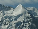
The Silberhorn (3,695 m) is a pyramid-shaped mountain of the Bernese Alps, to the northwest of the Jungfrau of which it is a satellite peak. A first attempt to reach the summit of the Silberhorn was made in June 1863 by M. v. Fellenberg from the Stufensteinalp on the east side of the valley of Lauterbrunnen. After 9 hours of most perilous climbing the party encountered an impracticable precipice of rock, and were forced to return. In the following month of August MM. Badeker and v. Fellenberg, with two guides of Grindelwald, and others, reached the summit from the Wengernalp. Ascending by the Guggi Glacier, they passed a night on the rocks at the foot of the Schneehorn, a buttress of the Jungfrau dividing the Guggi and Giessen Glaciers. On the following day they gained the desired summit by a long and difficult circuit under the cliffs of the Jungfrau. The still longer and equally difficult ascent of the Jungfrau was effected from this side for the first time two years later.The northwest ridge was first ascended in 1865 by the Rev. James John Hornby, Rev. Thomas Henry Philpot, with guides Christian and Ulrich Almer, Johann Bischof, and Christian Lauener. In a 1968 letter, J. R. R. Tolkien identified the Silberhorn as it appeared to him when camping near Mürren in 1911 as "the Silvertine (Celebdil) of my dreams".Near the bottom of the World Cup Lauberhorn downhill course is the Silberhornsprung, a jump with the Silberhorn visible in the background for the television audience.