Telscombe

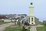
Telscombe is a civil parish and electoral ward (called East Saltdean and Telscombe Cliffs) with the status of a town in the Lewes District of East Sussex, England. It consists of three distinct settlements, separated from each other by an open area of downland called Telscombe Tye. Telscombe village is a small village on the South Downs, six miles (10 km) south of Lewes. It includes the parish church, with origins dating back to the 10th century. The village has a population of fewer than 50 people. The parish retains its ancient boundaries, which reach from the village to the coast, and the major part of the population is in the two coastal settlements. At the eastern end of the parish, about 4500 people live at Telscombe Cliffs, developed in the 20th century effectively as an extension of the town of Peacehaven over the town boundary. At the western end, the remaining 2500 population forms part of the community of Saltdean, the remainder of Saltdean being within the city of Brighton and Hove. In 1929, thanks to the growth in population, Telscombe gained a parish council: in 1974 it became a town, with a mayor. The new civic centre in Telscombe Cliffs came into use in 2000. The Prime Meridian crosses the northeast corner of Telscombe parish. The town has a school, Telscombe Cliffs Primary. The parish includes part of the Brighton to Newhaven Cliffs Site of Special Scientific Interest. The cliffs are mainly of geological interest, containing many Santonian and Campanian fossils. The SSSI listing includes flora and fauna biological interest too.
Excerpt from the Wikipedia article Telscombe (License: CC BY-SA 3.0, Authors, Images).Telscombe
Telscombe Cliffs Way,
Geographical coordinates (GPS) Address Nearby Places Show on map
Geographical coordinates (GPS)
| Latitude | Longitude |
|---|---|
| N 50.803 ° | E -0.01 ° |
Address
Telscombe Cliffs Way
BN10 7DR , Telscombe Cliffs
England, United Kingdom
Open on Google Maps


