Peacehaven
1916 establishments in EnglandCivil parishes in East SussexEngvarB from June 2018Populated coastal places in East SussexPopulated places established in 1916 ... and 2 more
Towns in East SussexVague or ambiguous time from March 2022

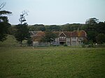
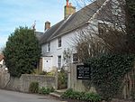
Peacehaven is a town and civil parish in the Lewes district of East Sussex, England. It is located above the chalk cliffs of the South Downs approximately six miles (9.7 km) east of Brighton city centre, on the A259 road. Its site coincides with the point where the Greenwich meridian crosses the English south coast. Peacehaven is next to Telscombe Cliffs, a later western extension to Peacehaven, which lies within a separate parish and has a separate town council.
Excerpt from the Wikipedia article Peacehaven (License: CC BY-SA 3.0, Authors, Images).Peacehaven
Firle Road,
Geographical coordinates (GPS) Address Nearby Places Show on map
Geographical coordinates (GPS)
| Latitude | Longitude |
|---|---|
| N 50.8 ° | E 0 ° |
Address
Firle Road
Firle Road
BN10 7QH , Peacehaven
England, United Kingdom
Open on Google Maps


