Caversham, Reading

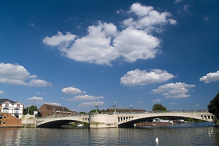
Caversham is a suburb of Reading, England, located directly north of the town centre across the River Thames. Caversham rises from the River Thames, lying on flood plain and the lowest reaches of the Chiltern Hills. Two road bridges, including Caversham Bridge, and two footbridges join Caversham to the rest of Reading. Named areas within the suburb include Emmer Green, Lower Caversham, Caversham Heights and Caversham Park Village. Notable landmarks include Caversham Court, a public park and former country house; Caversham Lakes; and part of the Thames Path national trail. Recorded as early as 1086, Caversham was a village part of the Henley district of Oxfordshire (it is located around 5.6 miles (9.0 km) south east of Henley). With the exception of the centre of Caversham and Emmer Green, which were traditional villages, much of the development occurred during the 20th century. In 1911, it was transferred to Berkshire and became part of the county borough of Reading.
Excerpt from the Wikipedia article Caversham, Reading (License: CC BY-SA 3.0, Authors, Images).Caversham, Reading
School Lane, Reading Caversham
Geographical coordinates (GPS) Address Nearby Places Show on map
Geographical coordinates (GPS)
| Latitude | Longitude |
|---|---|
| N 51.467 ° | E -0.973 ° |
Address
School Lane
School Lane
RG4 8HU Reading, Caversham
England, United Kingdom
Open on Google Maps


