Pipers Island
Geography of Reading, BerkshireIslands of the River ThamesUse British English from May 2017

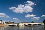
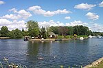
Pipers Island, or Piper's Island, is the third-smallest map-named island in the River Thames, in England. It is on the Reading, Berkshire reach (the head of water above Caversham Lock). It is toward the edge of the central urban area of the town of Reading and connected by a gangway to Caversham Bridge, a road and pedestrian bridge that links that town to its left bank suburb of Caversham.
Excerpt from the Wikipedia article Pipers Island (License: CC BY-SA 3.0, Authors, Images).Pipers Island
Promenade Road, Reading Caversham
Geographical coordinates (GPS) Address Nearby Places Show on map
Geographical coordinates (GPS)
| Latitude | Longitude |
|---|---|
| N 51.4657 ° | E -0.9765 ° |
Address
Island Bar & Restaurant
Promenade Road
RG4 8AL Reading, Caversham
England, United Kingdom
Open on Google Maps


