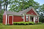
Putney (CDP), Vermont
Putney is the primary village and a census-designated place (CDP) in the town of Putney, Windham County, Vermont, United States. As of the 2020 census, it had a population of 571, compared to 2,617 in the entire town. The Putney Village Historic District occupies the center of the CDP. The CDP is in eastern Windham County, on the southern edge of the town of Putney. It is bordered to the south by the town of Dummerston. U.S. Route 5 is the village's Main Street; it leads north 13 miles (21 km) to Bellows Falls and south 9 miles (14 km) to Brattleboro. Sacketts Brook, a south-flowing tributary of the Connecticut River flows through the CDP. The village is sited where the brook drops 100 feet (30 m) in 0.2 miles (0.32 km).
Excerpt from the Wikipedia article Putney (CDP), Vermont (License: CC BY-SA 3.0, Authors).Putney (CDP), Vermont
Main Street,
Geographical coordinates (GPS) Address Nearby Places Show on map
Geographical coordinates (GPS)
| Latitude | Longitude |
|---|---|
| N 42.975 ° | E -72.521944444444 ° |
Address
Main Street
05346
Vermont, United States
Open on Google Maps


