Poocham, New Hampshire
New Hampshire geography stubsNew Hampshire placenames of Native American originUnincorporated communities in Cheshire County, New HampshireUnincorporated communities in New HampshireUse mdy dates from July 2023

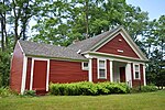
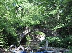
Poocham is an unincorporated community in the town of Westmoreland in Cheshire County, New Hampshire, United States, near the larger communities of Keene, New Hampshire and Brattleboro, Vermont. Poocham's oldest houses date from around 1800. By reputation, the name Poocham comes from an Abenaki Indian word meaning "gathering place". The community is almost entirely composed of homes and farms, but a small fluorite mine (called William Wise Mine) and growing vineyard (called Poocham Hill Winery) are also present.
Excerpt from the Wikipedia article Poocham, New Hampshire (License: CC BY-SA 3.0, Authors, Images).Poocham, New Hampshire
Poocham Road,
Geographical coordinates (GPS) Address Nearby Places Show on map
Geographical coordinates (GPS)
| Latitude | Longitude |
|---|---|
| N 42.950555555556 ° | E -72.477222222222 ° |
Address
Poocham Road
Poocham Road
03467
New Hampshire, United States
Open on Google Maps


